Mesoscale Discussion 1282
Issued: · Valid: –
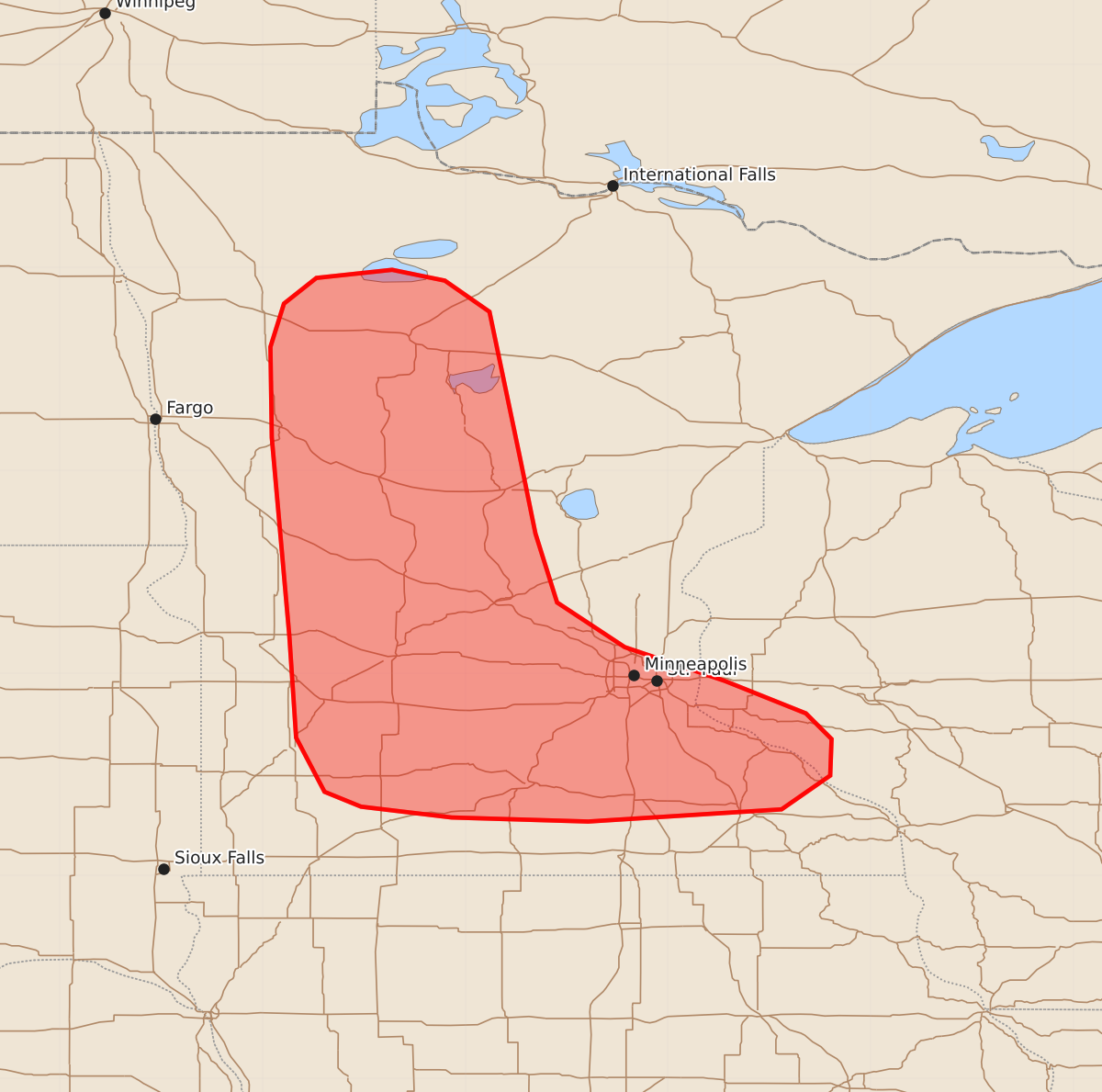
Summary
Isolated to scattered thunderstorms affecting portions of Minnesota and far western Wisconsin may produce large hail and brief tornadoes through the early evening. These storms are expected to persist for at least a few hours with the potential for moderate severity in localized areas.
Product Text
000 ACUS11 KWNS 232240 SWOMCD SPC MCD 232240 MNZ000-WIZ000-240015- Mesoscale Discussion 1282 NWS Storm Prediction Center Norman OK 0540 PM CDT Tue Jun 23 2026 Areas affected...portions of Minnesota into far western Wisconsin Concerning...Severe potential...Watch possible Valid 232240Z - 240015Z Probability of Watch Issuance...40 percent SUMMARY...Isolated to widely scattered thunderstorms continue to pose a risk for isolated large hail and perhaps a brief tornado or two. Watch issuance remains uncertain. DISCUSSION...Convective coverage has gradually increased across portions of Minnesota through early evening along a surface boundary. Isolated, transient supercell structures have been noted with this activity and have produced sporadic reports of brief funnel clouds and hail up to 1.75 inches in diameter over the past couple of hours. Expectation is for this activity to persist for at least another couple of hours, with two areas of locally greater severe potential evident within the broader discussion area. Across north-central Minnesota, isolated thunderstorms along an occluded front have shown brief upticks in intensity. Should a stronger cell become better established, isolated large hail and perhaps a brief tornado may be possible. Farther south, ongoing convection across south-central Minnesota continues to display signs of modest organization. The strongest cells continue to pose a risk for isolated large hail and a brief tornado, particularly with any cells that favorably interact with the surface warm front. Watch issuance remains uncertain owing to generally limited/marginal thermodynamic profiles and the isolated nature of the severe threat. ..Chalmers/Smith.. 06/23/2026 ...Please see www.spc.noaa.gov for graphic product... ATTN...WFO...DLH...ARX...MPX...FGF...FSD... LAT...LON 45279580 46749593 47419594 47739584 47929560 47989504 47909465 47679432 46579409 46039398 45529382 45199332 44949258 44709198 44519179 44249180 43999216 43909359 43939460 44019527 44129554 44529575 45279580 MOST PROBABLE PEAK TORNADO INTENSITY...UP TO 90 MPH MOST PROBABLE PEAK WIND GUST...UP TO 60 MPH MOST PROBABLE PEAK HAIL SIZE...1.00-1.75 IN