Mesoscale Discussion 2279
Issued: · Valid: –
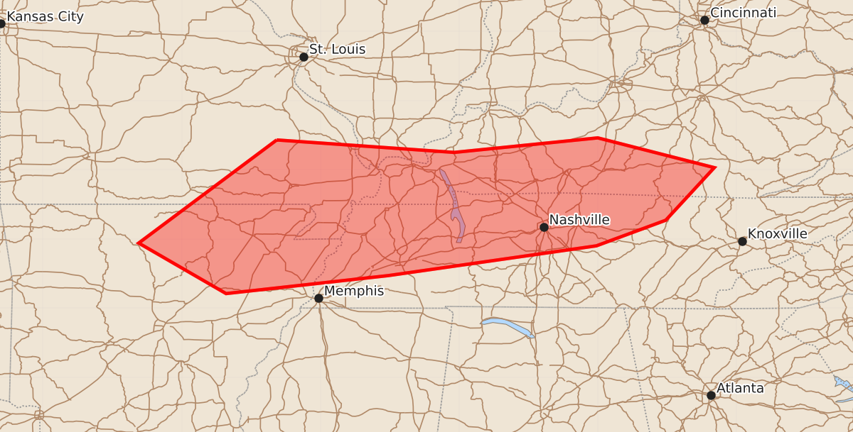
Summary
Scattered thunderstorms may produce damaging winds across northeast Arkansas and parts of Tennessee and Kentucky through the afternoon.
Product Text
000 ACUS11 KWNS 101915 SWOMCD SPC MCD 101915 KYZ000-TNZ000-ILZ000-MOZ000-ARZ000-102115- Mesoscale Discussion 2279 NWS Storm Prediction Center Norman OK 0215 PM CDT Thu Sep 10 2026 Areas affected...Northeast Arkansas into parts of Tennessee and Kentucky Concerning...Severe potential...Watch unlikely Valid 101915Z - 102115Z Probability of Watch Issuance...20 percent SUMMARY...Widely scattered thunderstorms will affect areas from northeast AR into portions of KY/TN through the afternoon. Locally damaging winds are possible. A watch is unlikely. DISCUSSION...Thunderstorms have begun to develop along an axis from northern AR into parts of KY/TN. This is along and south of a surface boundary, where temperatures have warmed into the upper 80-mid 90s. High PWAT values around 2 inches, MLCAPE over 1500 J/kg, and strong daytime heating suggest a few storms may occasionally produce gusty/damaging winds. Mid-level westerly flow of 25-30 knots may also encourage a few organized multicell clusters. Present indications are that the coverage of severe will be limited. ..Hart/Guyer.. 09/10/2026 ...Please see www.spc.noaa.gov for graphic product... ATTN...WFO...MRX...JKL...LMK...OHX...PAH...MEG...LSX...LZK... SGF... LAT...LON 37439063 37258807 37468600 37038432 36278502 35908602 35478902 35219136 35949262 37439063 MOST PROBABLE PEAK WIND GUST...55-70 MPH