Day 1 Convective Outlook
This product has been superseded. View the updated product →
Issued: · Valid: –
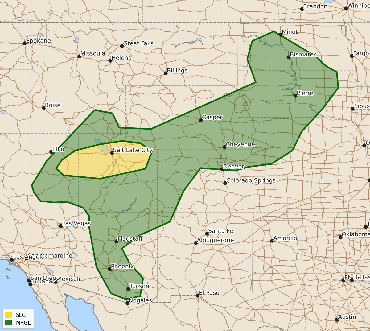
Summary
Scattered strong to severe thunderstorms capable of producing damaging wind gusts and hail are expected through Saturday evening across eastern Nevada, northern Utah, the northern Rockies, and the northern Plains.
Product Text
000 ACUS01 KWNS 291219 SWODY1 SPC AC 291217 Day 1 Convective Outlook NWS Storm Prediction Center Norman OK 0717 AM CDT Sat Aug 29 2026 Valid 291300Z - 301200Z ...THERE IS A SLIGHT RISK OF SEVERE THUNDERSTORMS FROM EASTERN NEVADA INTO NORTHERN UTAH... ...SUMMARY... Widely scattered strong to severe storms are expected across parts of the northern Great Basin, northern/central Rockies, and northern Plains. Severe wind gusts are the main threat. ...Great Basin into Central/Northern Rockies... A broad upper trough is present today across the Southern Rockies into OK/TX, with relatively fast flow aloft extending from NV into WY. IR satellite imagery suggests considerable cloud cover is affecting much of the Great Basin region, which will limit daytime heating/destabilization and overall severe threat. Nevertheless, there appears to be a corridor from eastern NV across parts of north-central UT where sufficient heating will result in steep low-level lapse rates and favorable CAPE profiles for a few high-based thunderstorms capable of damaging wind gusts. Supercell structures are also possible in this corridor, suggesting a risk of hail in the strongest storms. ...Northern Plains... Similar to yesterday, clusters of high-based showers and thunderstorms will spread eastward across WY into parts of the Dakotas/NE this afternoon and evening. Favorable winds aloft, combined with at least marginal CAPE will aid in a risk of locally damaging wind gusts and hail. ..Hart/Broyles.. 08/29/2026 $$