Day 1 Convective Outlook
Issued: · Valid: –
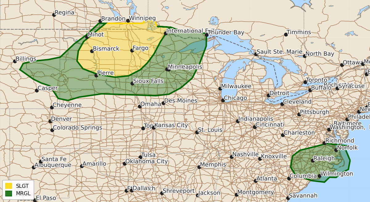
Summary
Scattered severe thunderstorms capable of producing large hail and damaging wind gusts will affect parts of the Dakotas and Minnesota throughout this evening and tonight.
Product Text
000 ACUS01 KWNS 200107 SWODY1 SPC AC 200105 Day 1 Convective Outlook NWS Storm Prediction Center Norman OK 0805 PM CDT Sun Jul 19 2026 Valid 200100Z - 201200Z ...THERE IS A SLIGHT RISK OF SEVERE THUNDERSTORMS ACROSS PARTS OF THE DAKOTAS/UPPER MIDWEST... ...SUMMARY... Scattered severe thunderstorms capable of large hail and wind gusts will remain possible mainly across the Dakotas into Minnesota. ...Northern Plains/Upper Midwest... Severe thunderstorms including some supercells will continue to focus this evening across the Dakotas, primarily across south-central/eastern North Dakota as well as north-central/eastern South Dakota, while also expanding into parts of Minnesota tonight. Bouts of large hail will remain possible along with severe-caliber wind gusts. This will be as storms progress east-southeastward with the primary moisture/instability axis, supported by an amplifying shortwave trough over Saskatchewan toward Manitoba, and the development of a modest-strength southwesterly low-level jet across the Upper Midwest tonight. ...Carolinas/Mid-Atlantic States... A few strong/locally severe storms could still occur this evening, but overall storm intensifies are expected to continue to wane with the loss of daytime heating. ..Guyer.. 07/20/2026 $$