Mesoscale Discussion 2291
Issued: · Valid: –
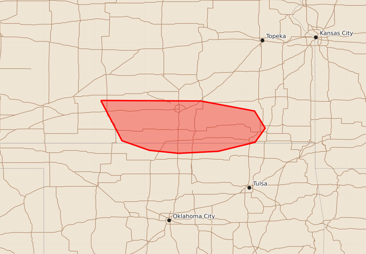
Summary
Severe thunderstorms capable of producing damaging winds and large hail are expected over portions of southern Kansas and far northern Oklahoma throughout the evening. The most intense storms may produce wind gusts as high as 80 mph and hail up to 2.5 inches in diameter.
Product Text
000 ACUS11 KWNS 130036 SWOMCD SPC MCD 130036 KSZ000-OKZ000-130130- Mesoscale Discussion 2291 NWS Storm Prediction Center Norman OK 0736 PM CDT Sat Sep 12 2026 Areas affected...portions of southern Kansas into far northern Oklahoma Concerning...Severe potential...Watch possible Valid 130036Z - 130130Z Probability of Watch Issuance...60 percent SUMMARY...The risk for severe wind and hail will increase over the next few hours as storms increase in coverage and traverse a surface boundary over southern KS. A few significant severe wind/hail events may occur with the strongest storms. A Severe Thunderstorm Watch will be considered in the short term. DISCUSSION...Thunderstorms are rapidly increasing in coverage and intensity along a surface baroclinic boundary. These storms are expected to propagate eastward along the boundary over the next several hours, where ample buoyancy and vertical wind shear are present (i.e. 3000 J/kg MLCAPE and 50 kts of effective bulk shear, respectively). Supercells and multicells should be the main storm mode, at least initially. However, if storms can merge, then a cold-pool-driven MCS may manifest. Given 8+ C/km mid-level lapse rates present (per the 00Z DDC observed sounding), supercell structures may produce 2+ inch diameter hail, with 75+ mph gusts possible with multicell structures or especially an MCS. ..Squitieri/Smith.. 09/13/2026 ...Please see www.spc.noaa.gov for graphic product... ATTN...WFO...TSA...ICT...OUN...DDC... LAT...LON 37859887 37849689 37649582 37309561 37029581 36849654 36809733 36869791 37059845 37859887 MOST PROBABLE PEAK WIND GUST...65-80 MPH MOST PROBABLE PEAK HAIL SIZE...1.50-2.50 IN