Mesoscale Discussion 1350
Issued: · Valid: –
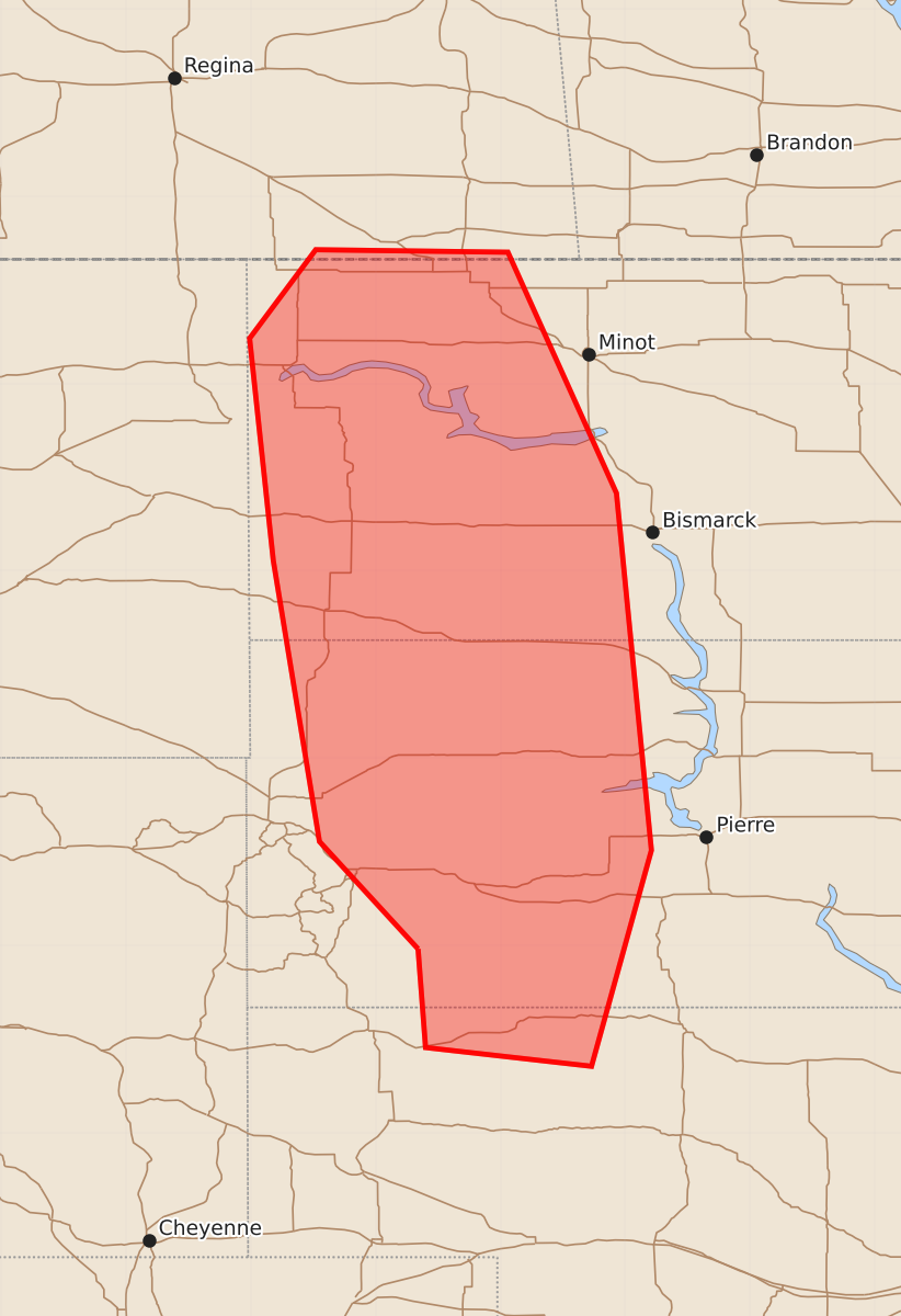
Summary
Severe thunderstorms capable of producing very large hail, damaging winds over 80 mph, and strong tornadoes are expected to develop across the western Dakotas into northwest Nebraska this evening. The threat will increase late this evening as storms move through the region.
Product Text
000 ACUS11 KWNS 271920 SWOMCD SPC MCD 271919 SDZ000-NEZ000-NDZ000-272145- Mesoscale Discussion 1350 NWS Storm Prediction Center Norman OK 0219 PM CDT Sat Jun 27 2026 Areas affected...the western Dakotas into northwest Nebraska Concerning...Severe potential...Watch likely Valid 271919Z - 272145Z Probability of Watch Issuance...95 percent SUMMARY...Severe thunderstorm development is expected to become increasingly likely by 21-22Z. All severe weather hazards are possible, including large to very large hail in excess of two inches, a strong tornado or two, and damaging winds with gusts of 80+ mph. A Tornado Watch is likely. DISCUSSION...A surface low currently analyzed northeast of Gillette, WY, is forecast to develop into northwest SD by late afternoon or early evening with an associated trough or pseudo-dryline moving into western parts of SD and the Nebraska Panhandle. The observed 18Z UNR sounding is a good representation of the warm sector ahead of those surface features with a pronounced EML and associated cap atop a relatively shallow moist layer. The cap is expected to inhibit surface-based thunderstorm development for the next couple of hours. Current water vapor imagery shows a cirrus streak and related mid-level convection moving into southern and central parts of WY, indicative of strong forcing for ascent within the exit region of mid/upper-level wind maxima moving through the Great Basin. That forcing for ascent is expected to overspread the discussion area late this evening, effectively eroding the cap and allowing for widely scattered thunderstorm development amidst a moderate to strongly unstable environment. Steadily strengthening deep-layer shear will support supercells as the initial storm mode with the primary hazard being large to very large hail. Low-level shear is forecast to strengthen this evening in the vicinity of the surface low in northwest SD and southwest ND with a conditional threat for a strong tornado or two. However, there is some uncertainty in convective mode at that time as deep-layer shear vectors tend to back to a more northerly direction in the vicinity of a stalled surface front along the MT border, which will be conducive for mixed storm modes. By late evening into tonight, latest short-term guidance indicates the evolution of a bow echo across western into central ND with more discrete storms persisting over western into central SD. Swaths of destructive winds with gusts of 80+ mph appear likely with the bow echo, while large hail and some tornado potential will exist with the SD storms. Storm initiation farther south into western NE remains uncertain. However, if a storm or two can develop, the environment will support a large to very large hail threat and perhaps a tornado. ..Mead/Guyer.. 06/27/2026 ...Please see www.spc.noaa.gov for graphic product... ATTN...WFO...ABR...BIS...LBF...UNR... LAT...LON 43470266 44330345 46580382 48360401 49070348 49050194 47120107 44260079 42530127 42680260 43470266 MOST PROBABLE PEAK TORNADO INTENSITY...120-145 MPH MOST PROBABLE PEAK WIND GUST...75-90 MPH MOST PROBABLE PEAK HAIL SIZE...2.00-3.50 IN