Mesoscale Discussion 1155
Issued: · Valid: –
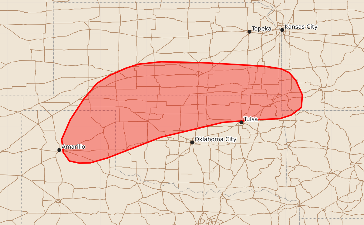
Summary
Isolated thunderstorms capable of producing large hail and damaging wind gusts are expected across the eastern Texas Panhandle, northern Oklahoma, southern Kansas, and the Ozarks through the early evening. The primary threat is golf-ball sized hail, though localized severe wind gusts are also possible.
Product Text
000 ACUS11 KWNS 162049 SWOMCD SPC MCD 162048 MOZ000-ARZ000-OKZ000-KSZ000-TXZ000-162245- Mesoscale Discussion 1155 NWS Storm Prediction Center Norman OK 0348 PM CDT Tue Jun 16 2026 Areas affected...portions of the central/southern Great Plains into the Ozarks Concerning...Severe potential...Watch possible Valid 162048Z - 162245Z Probability of Watch Issuance...40 percent SUMMARY...Isolated thunderstorm development is expected from the eastern Texas Panhandle into northern Oklahoma/southern Kansas and the Ozarks over the next 1-2 hours. Large hail will be the primary risk, with localized damaging wind gusts also possible. DISCUSSION...Latest GOES visible satellite imagery depicts developing cumulus across portions of the central/southern Great Plains ahead of a slow-moving surface cold front. Surface dewpoints range from the low-60s F across the eastern Texas Panhandle and northwest Oklahoma to the mid/upper 60s in northeastern Oklahoma. Coupled with diurnal heating, this is contributing to the development of 1000-2000+ J/kg MLCAPE. While some uncertainty remains regarding thunderstorm development owing to relatively neutral mid-level height falls, weak surface convergence along the front and erosion of remaining inhibition by surface heating may support isolated strong to severe thunderstorm development through early evening. Should storms develop, strong northwesterly mid-level flow and 40-50+ kts of effective shear will promote supercell development, with the primary risk being large hail. Warming mid-level temperatures and weakening mid-level lapse rates may tend to temper storm longevity/maintenance, but an instance or two of large hail to around golf-ball size (1.75") may be possible pending the development of a sustained supercell, with the greatest potential across northeast Oklahoma/southeast Kansas. Farther west, more isolated thunderstorm development may occur across the eastern TX/OK Panhandles. Continued heating/mixing will yield a deepening boundary layer through the afternoon, with steep low-level lapse rates and LCLs rising to 2-2.5 km. Isolated large hail and damaging/severe wind gusts may accompany any storms that do develop in this environment. ..Chalmers/Hart.. 06/16/2026 ...Please see www.spc.noaa.gov for graphic product... ATTN...WFO...SGF...TSA...ICT...OUN...DDC...AMA... LAT...LON 36129652 35849769 35649853 34970026 34810082 34800117 34870150 35150170 35570175 36210147 36880103 37380061 37640019 37879967 38009927 38089852 38059720 37989591 37939513 37859463 37739438 37489416 37019395 36609398 36369430 36249467 36219530 36129652 MOST PROBABLE PEAK WIND GUST...55-70 MPH MOST PROBABLE PEAK HAIL SIZE...1.00-1.75 IN