Mesoscale Discussion 1441
Issued: · Valid: –
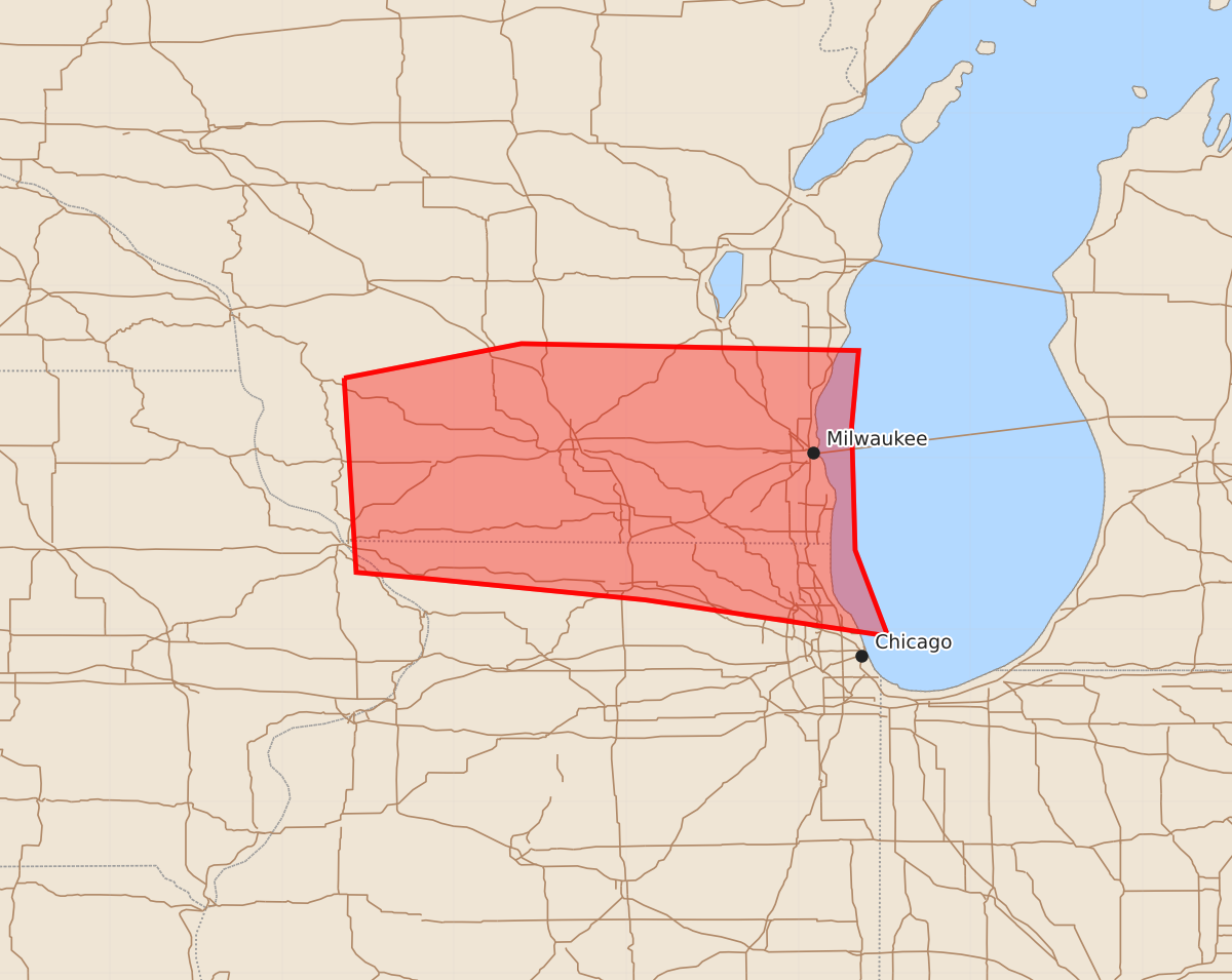
Summary
Severe storms capable of producing large hail, damaging winds, and potentially tornadoes are expected to move through southern Wisconsin and northern Illinois this afternoon and into the evening. The most intense storms may produce wind gusts up to 80 mph and hail as large as 1.75 inches.
Product Text
000 ACUS11 KWNS 021931 SWOMCD SPC MCD 021930 ILZ000-WIZ000-IAZ000-022100- Mesoscale Discussion 1441 NWS Storm Prediction Center Norman OK 0230 PM CDT Thu Jul 02 2026 Areas affected...southern Wisconsin and northern Illinois Concerning...Severe potential...Watch likely Valid 021930Z - 022100Z Probability of Watch Issuance...80 percent SUMMARY...A downstream watch will likely be needed this afternoon. DISCUSSION...The outflow boundary from this morning stalled across northern Illinois around mid-day and has started to lift north through the early afternoon. Expect this boundary to continue to move north as strong heating continues north of the boundary. Ongoing supercells to the west will continue to pose a large hail and damaging wind threat as they straddle the boundary, moving east this afternoon and into the evening. A locally higher tornado threat may exist along this boundary, especially if any supercells can latch on to it. Given current trends with storms to the west, a downstream watch will likely be needed by 4 PM, but if storms develop farther east along the boundary, a watch may be needed earlier. ..Bentley/Hart.. 07/02/2026 ...Please see www.spc.noaa.gov for graphic product... ATTN...WFO...LOT...MKX...DVN...ARX... LAT...LON 43469064 43668961 43628765 43188769 42468767 41968748 42178889 42299012 42339057 43469064 MOST PROBABLE PEAK TORNADO INTENSITY...UP TO 90 MPH MOST PROBABLE PEAK WIND GUST...65-80 MPH MOST PROBABLE PEAK HAIL SIZE...1.00-1.75 IN