Day 3 Convective Outlook
Issued: · Valid: –
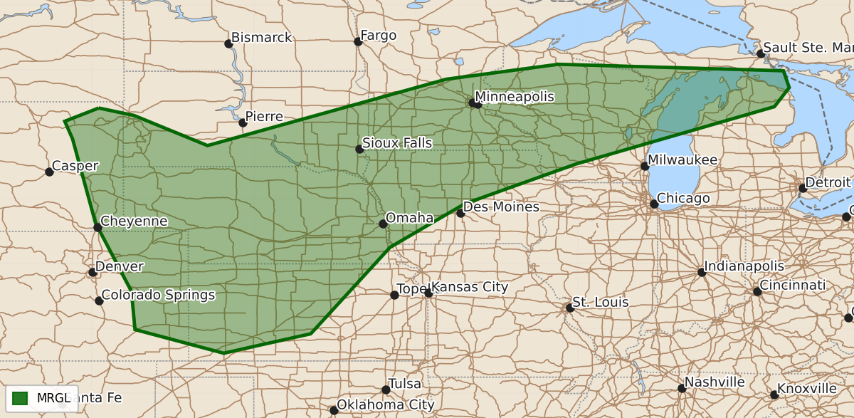
Summary
Strong thunderstorms with the potential for severe hail and wind are expected across parts of the Upper Midwest and central Great Plains on Wednesday through Wednesday night.
Product Text
000 ACUS03 KWNS 061925 SWODY3 SPC AC 061924 Day 3 Convective Outlook NWS Storm Prediction Center Norman OK 0224 PM CDT Mon Jul 06 2026 Valid 081200Z - 091200Z ...THERE IS A MARGINAL RISK OF SEVERE THUNDERSTORMS FROM THE CENTRAL PLAINS INTO THE UPPER MIDWEST... ...SUMMARY... Clusters of strong thunderstorms with potential to produce severe hail and wind may evolve across parts of the Upper Midwest into central Great Plains Wednesday through Wednesday night. ...Central Plains into the Upper Midwest... A generally zonal pattern will exist on Wednesday, with various disturbances moving across the northern Plains to Great Lakes. One disturbance will affect the upper MS Valley to Great Lakes during the day, with another developing late into the northern High Plains. Within the entire zone, midlevel westerlies will average 30-35 kt. In the low levels, a front should stretch from near Lake Superior into central NE, where it will stall. Widespread mid to upper 60s F dewpoints will remain ahead of the front, contributing to 2000-3000 J/kg MUCAPE by afternoon. Early activity is likely moving out of MN and into WI, and may overturn some of the air mass and push the effective boundary around. New diurnal storms are then likely during the afternoon, roughly from WI into southern MN and IA, with wind and hail potential. Farther west, scattered strong to severe storms are likely across the High Plains, where strong heating and steep lapse rates will favor development beneath modest northwest flow aloft. Moisture and instability look sufficient, but not overlay strong, and will support scattered strong to severe gusts and some hail. ..Jewell.. 07/06/2026 $$