Mesoscale Discussion 1467
Issued: · Valid: –
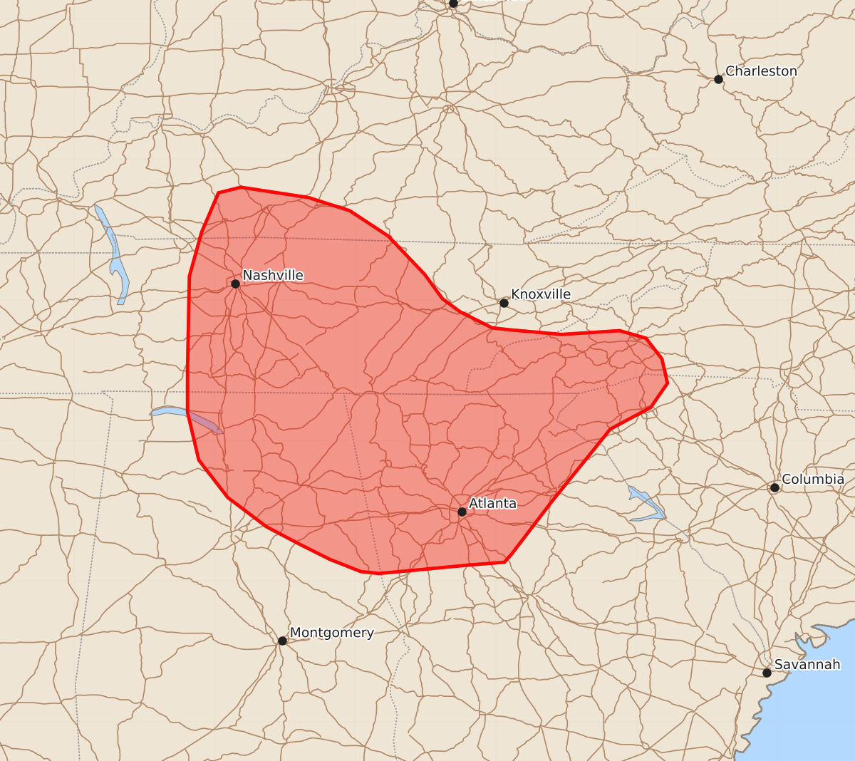
Summary
Scattered thunderstorms capable of producing damaging wind gusts up to 60 mph are expected across parts of northern Alabama, Georgia, and central and eastern Tennessee this afternoon. These storms may be marginally severe as they increase in coverage throughout the region.
Product Text
000 ACUS11 KWNS 031655 SWOMCD SPC MCD 031654 NCZ000-SCZ000-GAZ000-TNZ000-KYZ000-ALZ000-031900- Mesoscale Discussion 1467 NWS Storm Prediction Center Norman OK 1154 AM CDT Fri Jul 03 2026 Areas affected...Portions of Northern Alabama and Georgia into central and eastern Tennessee Concerning...Severe potential...Watch unlikely Valid 031654Z - 031900Z Probability of Watch Issuance...20 percent SUMMARY...Scattered thunderstorms -- some of which may be marginally severe -- are expected to develop and increase in coverage across much of the Southeast this afternoon. The strongest storms will be capable of damaging wind gusts of 60 MPH. DISCUSSION...Surface temperatures across much of the Southeast have reached the low 90s F, and as heating begins to reach convective temperature, thunderstorms are expected to increase in coverage and intensity. Being beneath an upper-level ridge, there is little in the way of vertical shear to support storm organization. However, loose clusters of multicellular thunderstorms will develop in well-mixed boundary layers with steep lapse rates, modest precipitable water content, and relatively high LCLs. This should support strong, wet downdrafts, with SPC Mesoanalysis indicating downdraft CAPE exceeding 1000 J/kg across much of the area. Along with the potential for wet microbursts, the scattered storm coverage can also result in loose organization along interacting outflow boundaries. Both scenarios could result in 60 MPH wind gusts and some wind damage. However, the overall pulse-convection nature and lack of clear organization mechanisms limits the confidence in severe coverage. While a severe thunderstorm watch is not anticipated at this time, conditions will continue to be monitored as convective coverage increases. ..Halbert/Hart.. 07/03/2026 ...Please see www.spc.noaa.gov for graphic product... ATTN...WFO...GSP...MRX...FFC...LMK...OHX...BMX...HUN...PAH... LAT...LON 33848341 33298383 33208391 33178429 33118492 33088525 33108544 33238577 33398609 33588645 33898686 34298717 34808729 35268729 36258727 36728714 37148696 37208672 37098600 36958556 36688515 36278476 36018457 35878438 35708404 35688386 35638330 35678268 35598240 35378223 35118217 34858235 34628278 33848341 MOST PROBABLE PEAK WIND GUST...UP TO 60 MPH MOST PROBABLE PEAK HAIL SIZE...UP TO 1.25 IN