Day 4-8 Convective Outlook
Issued: · Valid: –
Summary
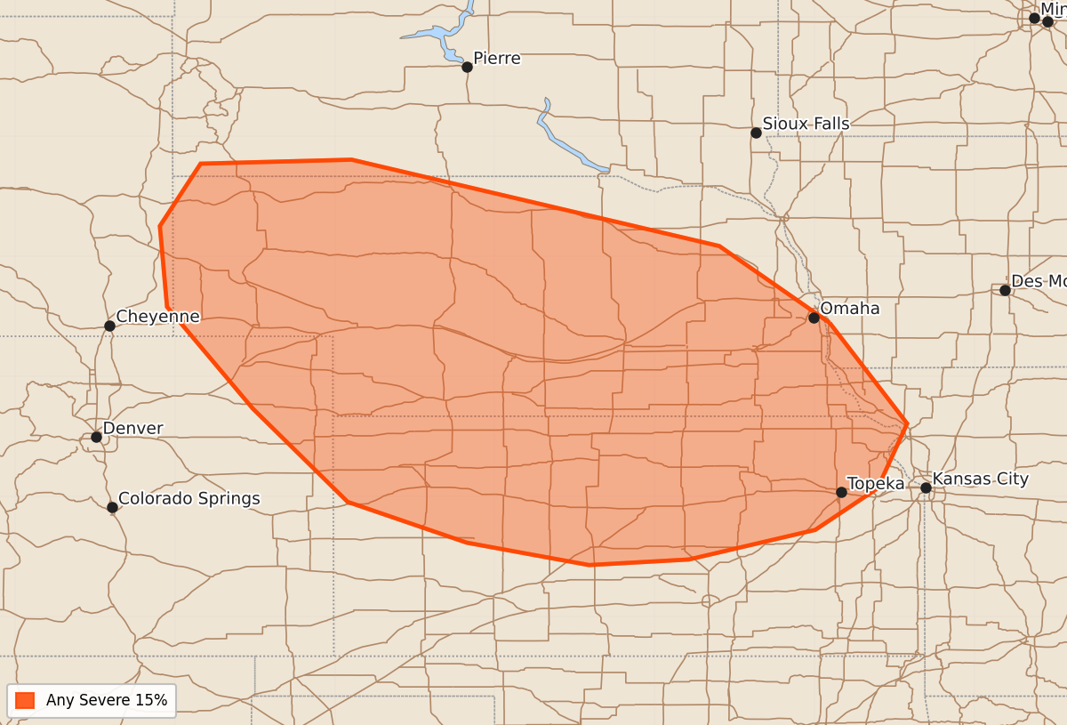
Severe thunderstorms are expected to develop across portions of the central Plains on Saturday afternoon and evening.
Product Text
000 ACUS48 KWNS 170723 SWOD48 SPC AC 170721 Day 4-8 Convective Outlook NWS Storm Prediction Center Norman OK 0221 AM CDT Wed Jun 17 2026 Valid 201200Z - 251200Z ...DISCUSSION... ...Day 4/Saturday - Central Plains... A mid/upper trough ejecting across the central Rockies into the Plains will break down the upper ridge centered over the Plains on Saturday. This will result in some enhancement of mid/upper level west/northwesterly flow. Surface lee troughing will extend from eastern WY through eastern CO, and increasing south/southeasterly low-level flow will transport 60s F dewpoints northward into NE and far southwest SD. Increasing boundary layer moisture and steepening midlevel lapse rates will support moderate destabilization by late afternoon and evening. Thunderstorms are expected to develop by 21-00z and migrate southeast, posing a severe risk across portions of the central Plains. ...Day 5/Sunday - OK/KS into the Mid-MS Valley... Medium range guidance varies considerably regarding evolution of a modest midlevel shortwave trough and associated surface low and cold front on Sunday. It is possible that an MCS related to Day 4/Saturday convection could be ongoing Sunday morning somewhere near the Mid-MO Valley. Depending on how surface feature evolve, a severe risk could develop across parts of eastern OK/KS into the Mid-MS Valley given a seasonally moist/unstable airmass and at least some enhancement of deep-layer flow from the mid/upper shortwave trough. However, placement of the surface low Sunday morning varies by a few hundred miles between the ECMWF and GFS deterministic members. The AIGFS is more similar to the ECMWF, but details remain quite different. This precludes a 15 percent delineation at this time, but probabilities may be needed at some point somewhere from OK/KS into the Mid-MS Valley/Mid-South regions. ...Days 6-8/Monday-Wednesday... A more June-like pattern appears to evolve through mid-week with weaker deep-layer flow expected amid weak troughing in the East and upper ridging across the West. Some severe thunderstorm potential could develop across the Plains as low-level moisture spreads northward beneath modest northwesterly flow aloft. However, predictability is low given a lack of stronger large-scale ascent. Daily thunderstorm chances will be driven by mesoscale processes not well resolved at longer time scale. ..Leitman.. 06/17/2026