Mesoscale Discussion 1580
Issued: · Valid: –
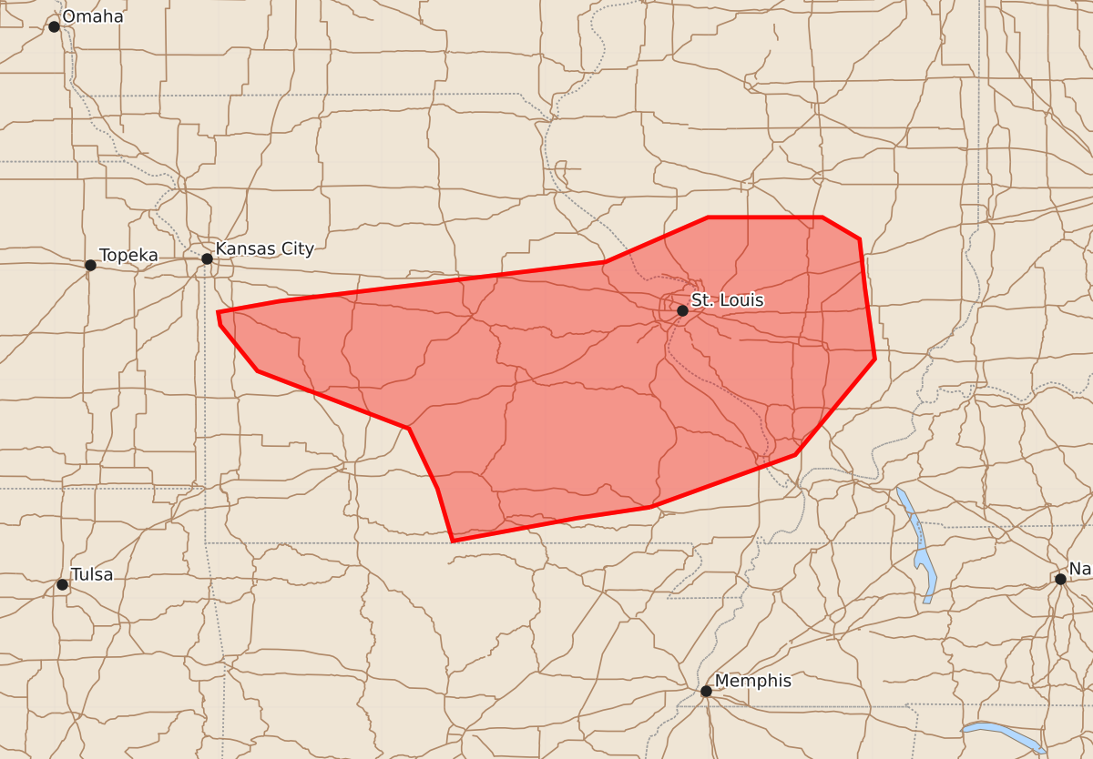
Summary
Increasing storm coverage across central and southern Missouri into southern Illinois may bring damaging winds and isolated hail through the early evening. Severe weather potential is possible during this time, though the exact timing and location of development remain uncertain.
Product Text
000 ACUS11 KWNS 102146 SWOMCD SPC MCD 102146 ILZ000-MOZ000-102345- Mesoscale Discussion 1580 NWS Storm Prediction Center Norman OK 0446 PM CDT Fri Jul 10 2026 Areas affected...Central/southern MO into southern IL Concerning...Severe potential...Watch possible Valid 102146Z - 102345Z Probability of Watch Issuance...40 percent SUMMARY...Some increase in storm coverage and intensity is possible into early evening. Watch issuance is possible, though timing is uncertain. DISCUSSION...To the south of a storm cluster moving across northern MO, rich low-level moisture and pockets of strong heating have resulted in substantial destabilization, with MLCAPE rising into the 2000-3000 J/kg range. Ascent attendant to a midlevel shortwave trough moving across IA/northern MO and modest low-level warm advection are expected to result in a general storm-coverage increase into this evening across central/southern MO into southern IL. However, details remain rather uncertain, due to the presence of substantial cloud cover over parts of southern MO. While storm development is possible anywhere within this corridor, there may be a tendency for initiation along the trailing outflow from the northern MO cluster, as well as along the periphery of the southern MO cloud deck. Deep-layer shear becomes increasingly modest with southward extent, but some increase in 850-700 mb southwesterly flow (already noted in the KSGF VWP) may allow for development of one or more forward-propagating clusters with a threat of damaging wind and isolated hail. Eventual watch issuance is possible for parts of this region, though timing remains uncertain. ..Dean/Thompson.. 07/10/2026 ...Please see www.spc.noaa.gov for graphic product... ATTN...WFO...PAH...ILX...LSX...SGF...EAX... LAT...LON 36839054 36739121 36529235 37009249 37559275 38089414 38509448 38629450 38729394 39089095 39499001 39498896 39298862 38848857 38198848 37318921 36839054 MOST PROBABLE PEAK TORNADO INTENSITY...UP TO 90 MPH MOST PROBABLE PEAK WIND GUST...55-70 MPH MOST PROBABLE PEAK HAIL SIZE...UP TO 1.25 IN