Mesoscale Discussion 1045
Issued: · Valid: –
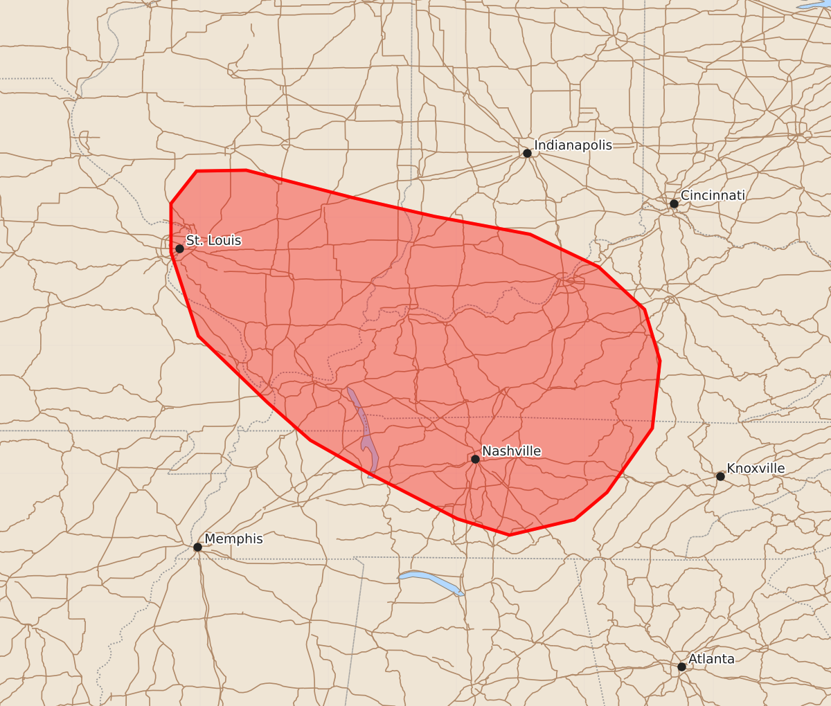
Summary
Severe thunderstorms capable of producing damaging wind gusts and occasional brief tornadoes may develop across portions of southern Illinois, southwestern Indiana, western and central Kentucky, and middle Tennessee through the afternoon.
Product Text
000 ACUS11 KWNS 091743 SWOMCD SPC MCD 091742 KYZ000-TNZ000-INZ000-ILZ000-MOZ000-091915- Mesoscale Discussion 1045 NWS Storm Prediction Center Norman OK 1242 PM CDT Tue Jun 09 2026 Areas affected...portions of southern Illinois...southwestern Indiana...western and central Kentucky...middle Tennessee Concerning...Severe potential...Watch possible Valid 091742Z - 091915Z Probability of Watch Issuance...40 percent SUMMARY...Storms may increase in coverage and intensity over the next several hours. Damaging gusts appear to be the main threat, though a couple of tornadoes may also occur. Convective trends are being monitored for the need of a WW issuance. DISCUSSION...Thunderstorms are developing along multiple diffuse heating zones, ahead of a remnant MCV centered over central MO. Given broad low-level convergence preceding the MCV, thunderstorm coverage may increase through the afternoon. Though mid-level lapse rates are expected to remain modest, low to mid 70s F surface dewpoints will support strong buoyancy (i.e. 2500+ J/kg MLCAPE). Despite poor vertical wind shear, the strong buoyancy may compensate to support damaging gusts via wet downbursts originating from stronger storm cores. Furthermore, any storms that can take advantage of preexisting ambient low-level vertical vorticity from the MCV or along surface boundaries may have the potential to produce a brief tornado. If greater convective coverage and intensity becomes apparent, a WW issuance may be needed. ..Squitieri/Mosier.. 06/09/2026 ...Please see www.spc.noaa.gov for graphic product... ATTN...WFO...MRX...JKL...LMK...OHX...IND...HUN...PAH...ILX... MEG...LSX... LAT...LON 36838921 37619002 38599034 39169034 39549004 39558946 39238822 39018726 38808614 38428534 37928480 37328462 36538471 35788524 35468562 35288638 35478699 36008802 36398871 36838921 MOST PROBABLE PEAK TORNADO INTENSITY...UP TO 90 MPH MOST PROBABLE PEAK WIND GUST...55-70 MPH