Mesoscale Discussion 1427
Issued: · Valid: –
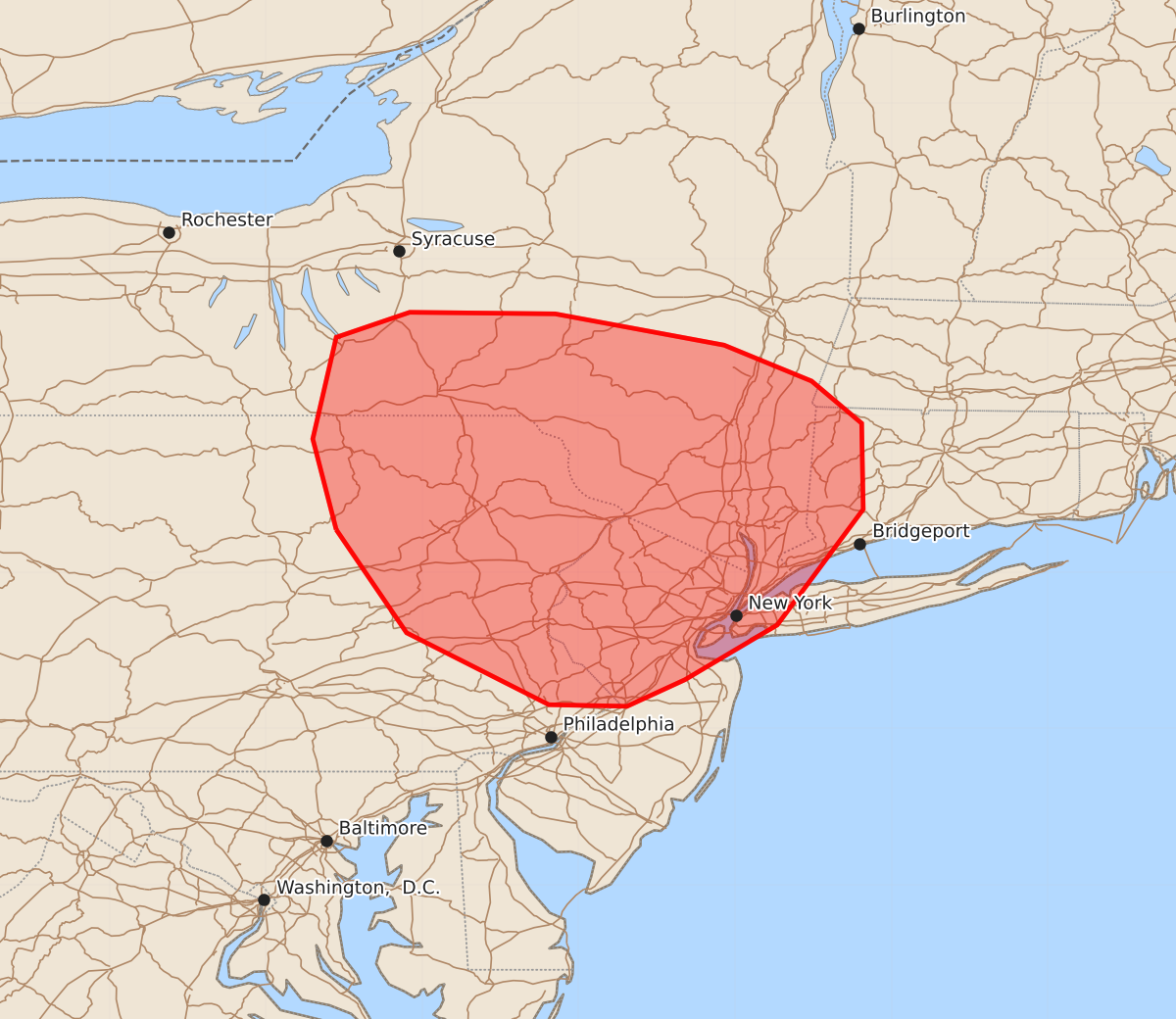
Summary
Isolated strong to severe thunderstorms are developing across portions of southern New York, northeastern Pennsylvania, and northern New Jersey this evening, bringing a localized risk of damaging wind gusts and large hail.
Product Text
000 ACUS11 KWNS 012240 SWOMCD SPC MCD 012240 CTZ000-MAZ000-NYZ000-NJZ000-PAZ000-020015- Mesoscale Discussion 1427 NWS Storm Prediction Center Norman OK 0540 PM CDT Wed Jul 01 2026 Areas affected...portions of the Northeast Concerning...Severe potential...Watch unlikely Valid 012240Z - 020015Z Probability of Watch Issuance...20 percent SUMMARY...Isolated strong to occasionally severe thunderstorms have developed across portions of southern New York, northeastern Pennsylvania, and northern New Jersey. These storms may pose a localized risk for damaging wind gusts and large hail. DISCUSSION...Isolated thunderstorms have developed across portions of the Northeast to the south of ongoing Severe Thunderstorm Watch 432 amid a hot, humid air mass. Weak effective shear and meager deep-layer flow (less than 25-30 kts sampled throughout the column by the BGM/ENX VWPs) will largely limit the potential for storm organization, but strong buoyancy, high moisture content, and modestly steep low-level lapse rates will support the potential for sporadic damaging wind gusts with stronger downbursts. Marginally severe hail may also occur with the strongest cores. The overall severe risk is generally expected to remain too isolated for watch issuance. A locally greater severe risk, primarily for damaging wind gusts, could materialize later this evening across the northern portions of the drawn area as an ongoing linear segment currently located north of Buffalo and modestly stronger mid/upper flow progress eastward. ..Chalmers/Thompson.. 07/01/2026 ...Please see www.spc.noaa.gov for graphic product... ATTN...WFO...OKX...ALY...PHI...BGM...CTP... LAT...LON 41277655 41857670 42507655 42667608 42657515 42457407 42227351 41957319 41407318 40667373 40317432 40147469 40157519 40617610 41277655 MOST PROBABLE PEAK WIND GUST...UP TO 60 MPH MOST PROBABLE PEAK HAIL SIZE...UP TO 1.25 IN