Mesoscale Discussion 1774
Issued: · Valid: –
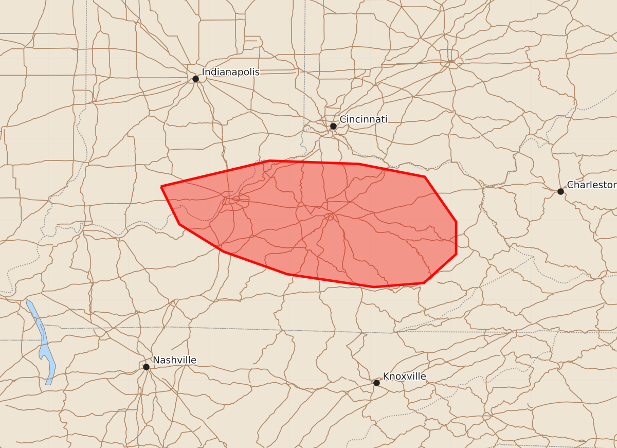
Summary
Severe thunderstorms capable of producing damaging wind gusts of 55 to 70 mph are expected to move through portions of southern Indiana and central to eastern Kentucky this evening.
Product Text
000 ACUS11 KWNS 272322 SWOMCD SPC MCD 272322 KYZ000-INZ000-280045- Mesoscale Discussion 1774 NWS Storm Prediction Center Norman OK 0622 PM CDT Mon Jul 27 2026 Areas affected...portions of far southern Indiana into central and eastern Kentucky Concerning...Severe potential...Severe Thunderstorm Watch likely Valid 272322Z - 280045Z Probability of Watch Issuance...80 percent SUMMARY...The severe threat will increase over the next few hours in central/eastern KY with the approach of storms from IN and southwestern OH. Damaging gusts are the main threat. A WW issuance may be needed in the next hour or so. DISCUSSION...A broken band of storms, with an appreciable history damaging gusts continues to propagate southward. The downstream airmass is moderately to strongly unstable (e.g. 2000-4000 J/kg MLCAPE), and adequately sheared (40+ kts of effective bulk shear). Given several hours remaining for diurnal heating ahead of these storms, the current thinking is that they will pose a damaging gust threat in central and eastern KY through at least sunset. As such, a Severe Thunderstorm Watch will likely be needed to address the impending threat. ..Squitieri/Smith.. 07/27/2026 ...Please see www.spc.noaa.gov for graphic product... ATTN...WFO...RLX...JKL...ILN...LMK... LAT...LON 38418660 38738525 38698414 38538332 37978293 37578293 37218333 37168395 37328503 37608582 37948637 38418660 MOST PROBABLE PEAK WIND GUST...55-70 MPH