Mesoscale Discussion 1158
Issued: · Valid: –
Summary
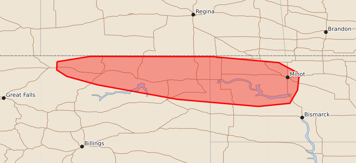
Isolated severe wind gusts and small hail may develop across northern and northeast Montana and northwest North Dakota during the next few hours. The expected severity includes wind gusts up to 70 mph and hail up to 1.25 inches.
Product Text
000 ACUS11 KWNS 162226 SWOMCD SPC MCD 162225 NDZ000-MTZ000-170030- Mesoscale Discussion 1158 NWS Storm Prediction Center Norman OK 0525 PM CDT Tue Jun 16 2026 Areas affected...northern into northeast MT and northwest ND Concerning...Severe potential...Watch unlikely Valid 162225Z - 170030Z Probability of Watch Issuance...20 percent SUMMARY...The risk for isolated severe gusts and perhaps marginally severe hail will develop as storms intensify during the next few hours. DISCUSSION...Widely scattered thunderstorms are developing ahead of an amplifying upper trough over southern Alberta. GOES and model-based upper flow fields show very strong westerly flow with 80+ kt flow at 8 km AGL per the Glasgow, MT WSR-88D VAD. Although low-level moisture is modest (surface dewpoints ranging from 45-50 deg F), steepened 0-3 km lapse rates and cool mid levels are supporting upwards of 500-1000 J/kg SBCAPE. Very long hodographs will support storm organization mainly in the form of a couple of supercells early during the convective life cycle before more storms and coalescing cold pools promotes more of a multicell mode. The greater risk for severe hail will accompany the supercells before the risk for severe gusts also begins to increase owing to higher storm coverage. ..Smith/Gleason.. 06/16/2026 ...Please see www.spc.noaa.gov for graphic product... ATTN...WFO...BIS...GGW...TFX... LAT...LON 48780942 48970824 48960393 48750161 48360088 47780094 47310121 47200232 47450518 47960798 48260907 48490943 48780942 MOST PROBABLE PEAK WIND GUST...55-70 MPH MOST PROBABLE PEAK HAIL SIZE...UP TO 1.25 IN