Mesoscale Discussion 1186
Issued: · Valid: –
Summary
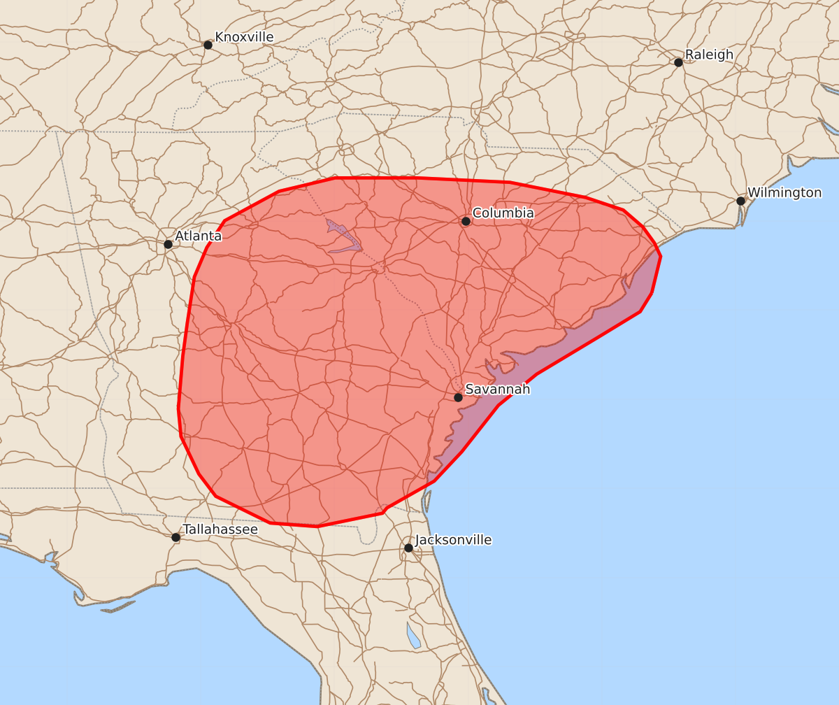
Isolated strong, damaging downburst winds are possible across parts of Georgia and South Carolina this afternoon and evening. These wind gusts could reach up to 60 mph.
Product Text
000 ACUS11 KWNS 181918 SWOMCD SPC MCD 181917 SCZ000-GAZ000-FLZ000-182115- Mesoscale Discussion 1186 NWS Storm Prediction Center Norman OK 0217 PM CDT Thu Jun 18 2026 Areas affected...portions of the Southeast Concerning...Severe potential...Watch unlikely Valid 181917Z - 182115Z Probability of Watch Issuance...5 percent SUMMARY...Isolated strong/damaging downburst winds are possible this afternoon and evening. Watch issuance is not expected. DISCUSSION...Latest surface observations depict a hot, humid air mass in place across portions of the Southeast, with temperatures in the upper-80s/low-90s F and dewpoints in the mid-70s to near 80 contributing to moderate to strong buoyancy (2500-3000 J/kg MLCAPE). While effective shear remains weak across the discussion area owing to weak mid-level flow (as sampled by the 18z JAX observed sounding), rich tropical moisture and PWAT exceeding 1.9-2.0" will promote an isolated risk for water-loaded downbursts capable of damaging wind gusts. The best potential for occasionally damaging downbursts likely exists from southern South Carolina into central and southeastern Georgia where the best overlap between buoyancy, high PWAT values, and modestly-steep low-level lapse rates exists. Given the isolated nature of this threat and the limited potential for greater storm organization, watch issuance is not expected. A more appreciable severe weather threat is expected to develop across portions of western Georgia later this afternoon/evening. See Tornado Watch 354 and Mesoscale Discussion #1185 for additional details. ..Chalmers/Hart.. 06/18/2026 ...Please see www.spc.noaa.gov for graphic product... ATTN...WFO...ILM...CHS...CAE...GSP...JAX...FFC...TAE... LAT...LON 33197894 32987907 32707953 32288023 31938066 31418107 31088138 30788191 30728196 30578269 30618322 30918383 31168402 31588422 31898425 32488420 32858415 33378407 33708393 34008373 34338312 34488249 34488157 34438053 34267968 34127926 33937904 33757891 33607884 33197894 MOST PROBABLE PEAK WIND GUST...UP TO 60 MPH