Day 1 Convective Outlook
This product has been superseded. View the updated product →
Issued: · Valid: –
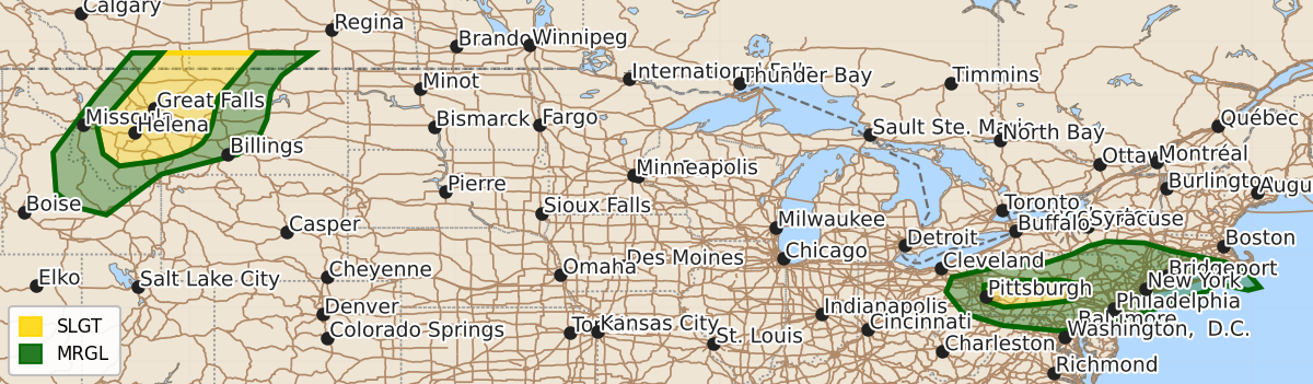
Summary
Severe thunderstorms capable of damaging winds and hail are expected across portions of western Montana and central Pennsylvania through early Sunday morning. In central Pennsylvania, the threat of damaging wind gusts is expected to diminish within the next couple of hours.
Product Text
000 ACUS01 KWNS 190102 SWODY1 SPC AC 190100 Day 1 Convective Outlook NWS Storm Prediction Center Norman OK 0800 PM CDT Sat Jul 18 2026 Valid 190100Z - 191200Z ...THERE IS A SLIGHT RISK OF SEVERE THUNDERSTORMS ACROSS CENTRAL PENNSYLVANIA AND ACROSS PORTIONS OF WESTERN MONTANA... ...SUMMARY... Storms capable of wind damage may continue for another hour or so across central Pennsylvania before dissipating. Additional strong-to-severe thunderstorms capable of damaging winds and hail will be likely across portions western Montana ... 01Z Update ... Overall thunderstorm intensity continues to wane across much of the northeast with the loss of daytime heating and multiple rounds of thunderstorms acting to stabilize the airmass. However, a few damaging thunderstorm wind gusts will be possible from far eastern Ohio into southern New England for perhaps another hour or two. The most likely area for wind damage is across central Pennsylvania where the most intense thunderstorms are currently found. These storms should weaken further in the next couple of hours, bringing an end to the organized severe threat. Across western Montana, sufficient buoyancy is in place to support ongoing convection, some of which has produced severe wind gusts this afternoon. Steep lapse rates coupled with gradually strengthening mid-level flow will support an ongoing severe threat, including a couple of outflow-driven convective clusters. Please see MCD #1656 for more details. ..Marsh.. 07/19/2026 $$