Mesoscale Discussion 1603
Issued: · Valid: –
Summary
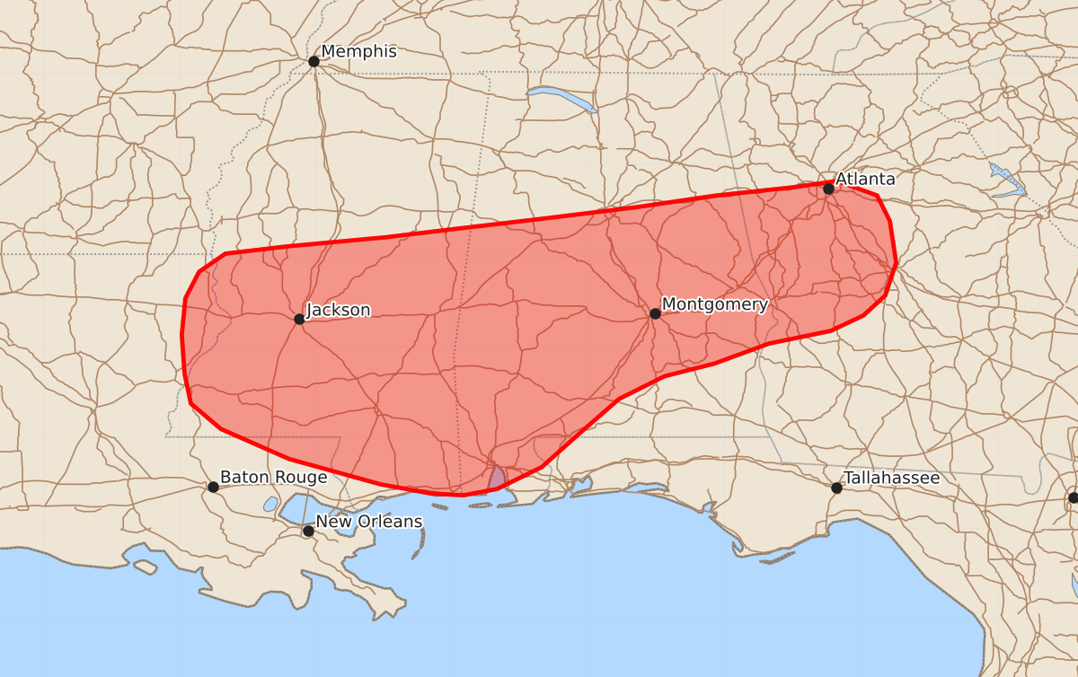
Widely scattered strong thunderstorms may bring localized damaging wind gusts to portions of the lower Mississippi Valley and the Southeast this afternoon and evening. These isolated storms could produce wind gusts up to 60 mph.
Product Text
000 ACUS11 KWNS 121752 SWOMCD SPC MCD 121752 GAZ000-ALZ000-FLZ000-MSZ000-LAZ000-121945- Mesoscale Discussion 1603 NWS Storm Prediction Center Norman OK 1252 PM CDT Sun Jul 12 2026 Areas affected...portions of the lower Mississippi Valley into the Southeast Concerning...Severe potential...Watch unlikely Valid 121752Z - 121945Z Probability of Watch Issuance...5 percent SUMMARY...Widely scattered strong to occasionally severe thunderstorms may bring a low probability risk for localized damaging downburst wind gusts. DISCUSSION...Increasingly agitated cumulus, and a few isolated thunderstorms, were evident on visible satellite and regional radar imagery across the lower Mississippi Valley and portions of the Southeast/Gulf Coast as of 1750 UTC. This activity is located within a warm and moist low-level air mass to the south of a surface frontal boundary. Aided by forcing for ascent ahead of a mid-level shortwave trough, convection is forecast to increase in coverage over the next several hours, with the greatest coverage likely to occur where any consolidated cold pools intersect the inland-progressing sea breeze later this afternoon/evening. Slightly cooler surface temperatures should yield marginally weaker low-level lapse rates (relative to areas farther east); however, localized damaging downburst winds may still occur given PW near 2 inches across the region. This threat is expected to remain too isolated to warrant watch issuance. ..Chalmers/Smith.. 07/12/2026 ...Please see www.spc.noaa.gov for graphic product... ATTN...WFO...FFC...BMX...MOB...JAN...LIX... LAT...LON 31709145 32139148 32539144 32829129 33029100 33109032 33208924 33298849 33408755 33538649 33668560 33758476 33828427 33668383 33388369 32928362 32568374 32348398 32178434 32038502 31818562 31678617 31428667 31018714 30678752 30438801 30368838 30388874 30488929 30769030 31099105 31379138 31709145 MOST PROBABLE PEAK WIND GUST...UP TO 60 MPH