Watch 424 Outline
Issued:
Summary
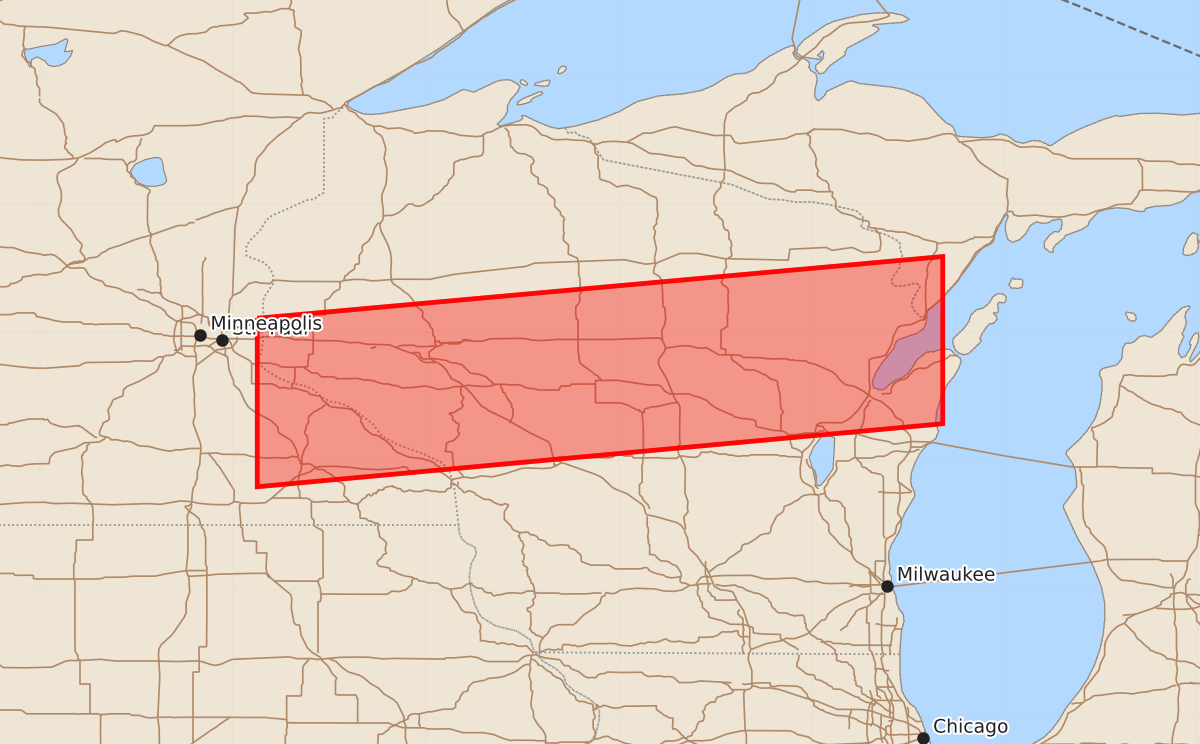
A severe thunderstorm watch is in effect for portions of southern Minnesota and northeastern Iowa through eastern Wisconsin until approximately 8:00 PM. Expected hazards include large hail up to two inches and wind gusts of 60 knots.
Product Text
000 WWUS30 KWNS 302017 SAW4 SPC AWW 302017 WW 424 SEVERE TSTM MN WI LM 302020Z - 010300Z AXIS..45 STATUTE MILES NORTH AND SOUTH OF LINE.. 40NNW RST/ROCHESTER MN/ - 45NE GRB/GREEN BAY WI/ ..AVIATION COORDS.. 40NM N/S /31SE MSP - 38NE GRB/ HAIL SURFACE AND ALOFT..2 INCHES. WIND GUSTS..60 KNOTS. MAX TOPS TO 600. MEAN STORM MOTION VECTOR 24025. LAT...LON 45119281 45598748 44298748 43809281 THIS IS AN APPROXIMATION TO THE WATCH AREA. FOR A COMPLETE DEPICTION OF THE WATCH SEE WOUS64 KWNS FOR WOU4.