Mesoscale Discussion 1254
Issued: · Valid: –
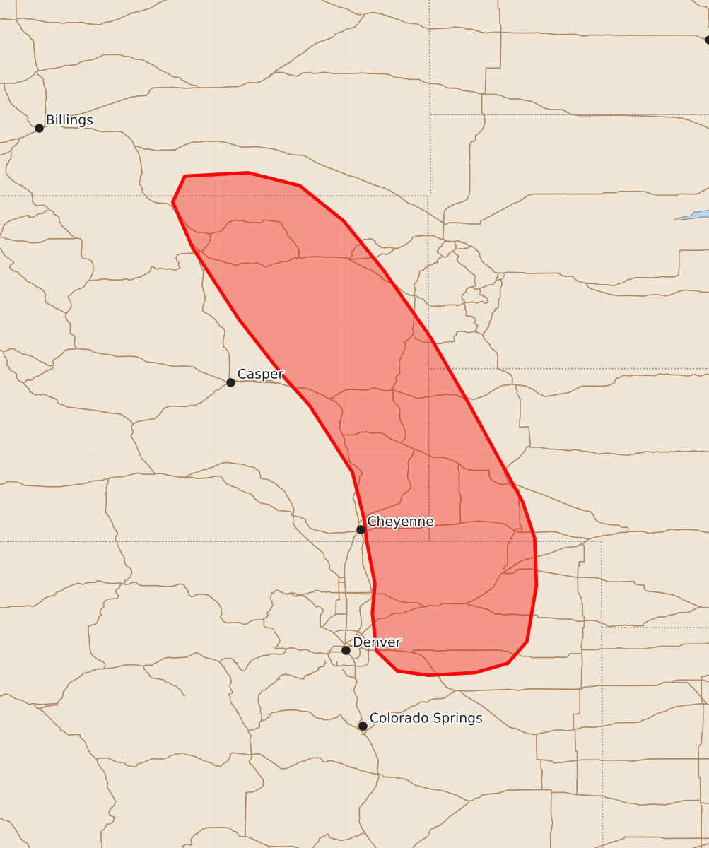
Summary
Severe thunderstorms capable of producing very large hail and brief tornadoes are expected to develop across southeast Wyoming and into parts of Nebraska, Colorado, South Dakota, and Montana this afternoon. These storms may become intense supercells through the late afternoon.
Product Text
000 ACUS11 KWNS 221730 SWOMCD SPC MCD 221729 NEZ000-COZ000-SDZ000-WYZ000-MTZ000-221930- Mesoscale Discussion 1254 NWS Storm Prediction Center Norman OK 1229 PM CDT Mon Jun 22 2026 Areas affected...Southeast Wyoming into adjacent portions of Nebraska...Colorado...South Dakota...and Montana Concerning...Severe potential...Watch likely Valid 221729Z - 221930Z Probability of Watch Issuance...80 percent SUMMARY...Thunderstorm development appears likely in the next couple of hours across southeast Wyoming. Storms that develop will likely mature into supercells posing a threat for very large hail; watch issuance will likely be needed as convection begins to develop. DISCUSSION...Latest GOES imagery shows a small zone of deepening cumulus within a weak upslope flow regime along the eastern slopes of the Laramie and Big Horn Mountains in Wyoming. Latest forecast guidance suggests that lingering mixed-layer inhibition will be largely eroded as temperatures warm into the mid to upper 70s. With observed temperatures in the vicinity of the deepening cumulus currently in the upper 60s and low 70s, it appears likely that further growth will occur with increasing probability for convective initiation over the next couple of hours - especially as broad-scale ascent ahead of an upstream wave continues to overspread the region. Regional VWPs are sampling 35-45 knot mid-level flow, which should increase through late afternoon as the mid-level disturbance continues to the southeast. This will yield elongated hodographs with effective shear values on the order of 40-50 knots by late afternoon, which will promote splitting supercells capable of producing very large hail (possibly as high as 2.5 to 3 inches based on sounding analogs). Large hail, as well as brief tornado, potential appears highest across southeast WY into northeast CO/western NE where richer low-level moisture will support higher buoyancy and more intense updrafts and some effective SRH is noted in latest RAP mesoanalyses. Trends are being monitored for the onset of more substantial/widespread initiation, and watch issuance will likely be needed once this becomes apparent. ..Moore/Hart.. 06/22/2026 ...Please see www.spc.noaa.gov for graphic product... ATTN...WFO...UNR...BOU...CYS...BYZ...RIW... LAT...LON 41040280 40490278 39840289 39590311 39480349 39450403 39500439 39730463 40170468 40510465 41030475 41240477 41800491 42580541 42900570 43580623 44400676 44930699 45230685 45270612 45120552 44710501 44140455 43370401 42610357 41460294 41040280 MOST PROBABLE PEAK TORNADO INTENSITY...85-110 MPH MOST PROBABLE PEAK WIND GUST...55-70 MPH MOST PROBABLE PEAK HAIL SIZE...2.00-3.50 IN