Mesoscale Discussion 1631
Issued: · Valid: –
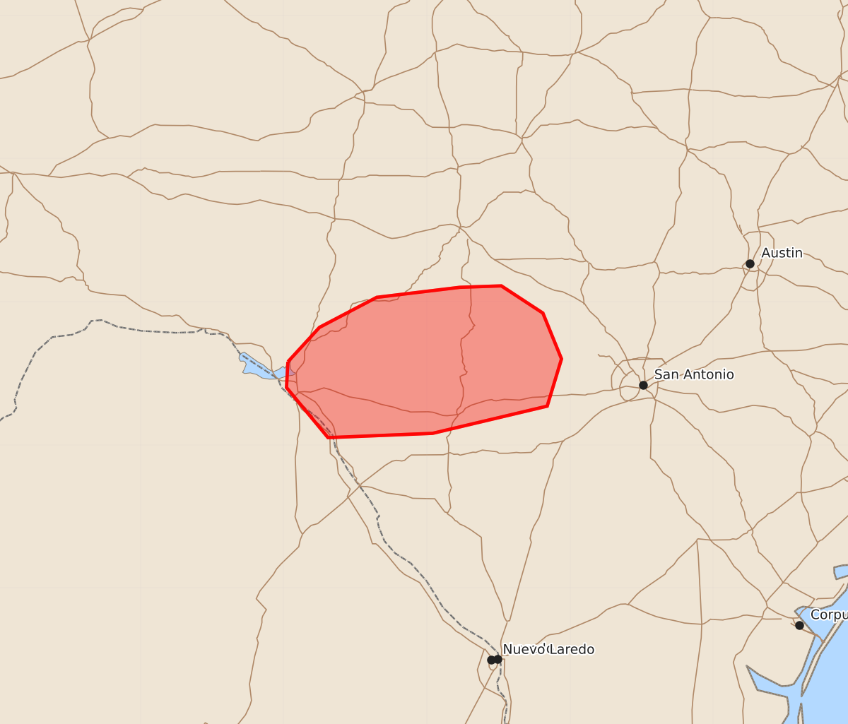
Summary
Brief tornado potential may continue across portions of south-central Texas during the morning of July 16. These isolated storms could produce transient circulations with wind speeds up to 90 mph.
Product Text
000 ACUS11 KWNS 161131 SWOMCD SPC MCD 161130 TXZ000-161330- Mesoscale Discussion 1631 NWS Storm Prediction Center Norman OK 0630 AM CDT Thu Jul 16 2026 Areas affected...portions of south-central Texas Concerning...Severe potential...Watch unlikely Valid 161130Z - 161330Z Probability of Watch Issuance...20 percent SUMMARY...Brief tornado potential may continue over the next couple of hours. DISCUSSION...Clusters of thunderstorm activity across south-central Texas have included embedded supercell activity that produced several transient circulations overnight. This is ongoing within a plume of tropical moisture along and near a stationary boundary draped across south-central and southern coastal Texas. The low-level jet (LLJ) has been steadily increasing over the last few hours and appears to be nearing peak, around 30-35 kts from the south. This is well sampled from the VAD from DFX where 0-3 km SRH is around 250-350 m2/s2. Despite overnight rainfall, MLCAPE around 500-1500 J/-kg remains in place with dew points in the mid to upper 70s south of the boundary. With the increase in low-level shear, a brief uptick in tornado potential may be possible before decreasing as the LLJ decreases through the morning. Given the isolated and brief nature of this threat, a watch is not anticipated. ..Thornton/Gleason.. 07/16/2026 ...Please see www.spc.noaa.gov for graphic product... ATTN...WFO...EWX... LAT...LON 29580097 29820075 30030035 30109977 30119948 29929919 29609906 29279916 29089996 29050069 29400098 29580097 MOST PROBABLE PEAK TORNADO INTENSITY...UP TO 90 MPH