Mesoscale Discussion 1480
Issued: · Valid: –
Summary
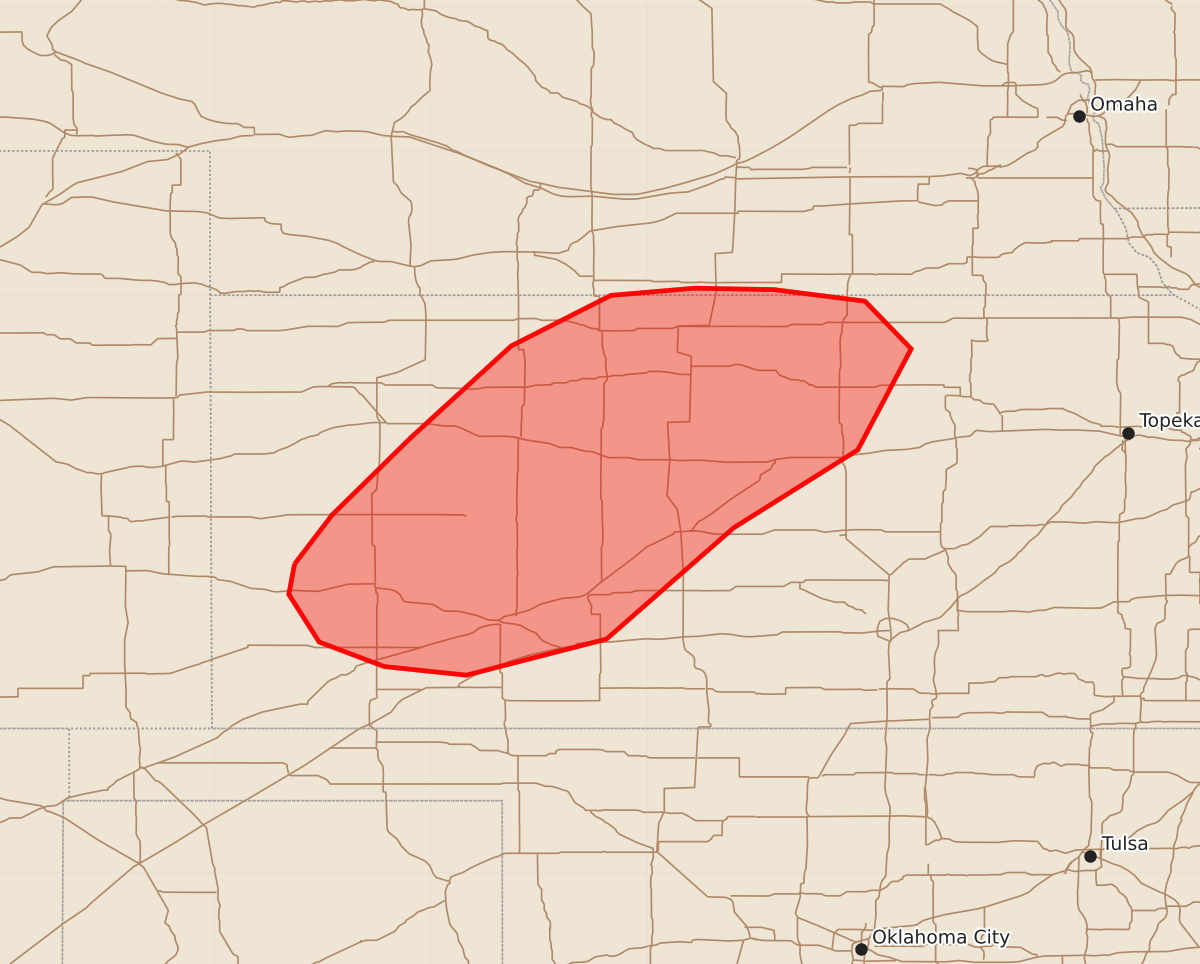
Severe wind gusts and isolated large hail are possible across west-central and north-central Kansas this evening.
Product Text
000 ACUS11 KWNS 032338 SWOMCD SPC MCD 032337 KSZ000-NEZ000-040130- Mesoscale Discussion 1480 NWS Storm Prediction Center Norman OK 0637 PM CDT Fri Jul 03 2026 Areas affected...West-central and north-central Kansas Concerning...Severe potential...Watch possible Valid 032337Z - 040130Z Probability of Watch Issuance...60 percent SUMMARY...Severe wind gusts and isolated large hail will be possible across parts of west-central and north-central Kansas this evening. A weather watch will need to be considered. DISCUSSION...The latest surface analysis shows a 1007 mb low over the western Oklahoma Panhandle with an axis of low-level convergence extending northeastward across western and northern Kansas. Surface dewpoints near and to the east of the axis are in the mid 60s to mid 70s F. This is contributing to a strongly unstable airmass with the RAP showing MLCAPE in the 3000 to 4500 J/kg range. As a mid-level shortwave trough and vorticity max moves eastward across the central High Plains early this evening, thunderstorms are expected to develop along and near the instability axis. The latest WSR-88D VWP at Dodge City has 0-6 km shear near 40 knots with some directional shear in the 1 to 4 km layer. This should support supercell development. Supercells will likely be capable of isolated large hail and severe wind gusts. Severe gusts may also occur with any intense short line segment that can become organized. ..Broyles/Gleason.. 07/03/2026 ...Please see www.spc.noaa.gov for graphic product... ATTN...WFO...TOP...ICT...GID...DDC...GLD... LAT...LON 38140144 37930148 37600127 37430082 37370025 37629928 38399840 38939754 39639717 39969749 40049812 40059867 40009925 39659994 39020063 38480118 38140144 MOST PROBABLE PEAK WIND GUST...65-80 MPH MOST PROBABLE PEAK HAIL SIZE...1.50-2.50 IN