Mesoscale Discussion 1315
Issued: · Valid: –
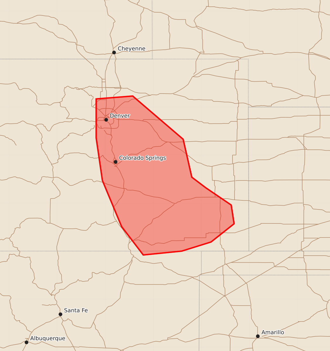
Summary
Isolated to widely scattered severe thunderstorms capable of large hail and strong wind gusts are possible across central and southeast Colorado this afternoon.
Product Text
000 ACUS11 KWNS 252024 SWOMCD SPC MCD 252024 COZ000-NMZ000-252300- Mesoscale Discussion 1315 NWS Storm Prediction Center Norman OK 0324 PM CDT Thu Jun 25 2026 Areas affected...Central and Southeast Colorado Concerning...Severe potential...Watch possible Valid 252024Z - 252300Z Probability of Watch Issuance...40 percent SUMMARY...Isolated to widely scattered severe storms capable of large hail and severe wind gusts appear possible across the discussion area this afternoon. Convective trends are being monitored for a possible Severe Thunderstorm Watch. DISCUSSION...Over the past couple of hours, regenerative thunderstorm development has been observed along the CO Front Range in the vicinity of Colorado Springs with additional deepening cumulus development noted from along the Sangre De Cristo Mountains in southeast CO to the Raton Mesa vicinity in far northeast NM. Latest surface observations indicate the presence of a moist, post-frontal air mass in place to the immediate east with dewpoints in the 50s and estimated MLCAPE of 1000-1500 J/kg. However, objective fields indicate some degree of capping in place, which may tend to keep any storm development confined to the immediate high terrain, at least in the near term. The exception is along the Raton Mesa in the vicinity of a surface cold front, where stronger boundary-layer heating is allowing a deepening cumulus field to spread east into the High Plains. Afternoon water vapor imagery indicates the discussion area is on the southern fringe of better implied forcing for ascent attendant to a short-wave trough moving into the NE Panhandle. As such, storms may remain isolated to widely scattered in nature. Current VWPs from KFTG and KPUX indicate east-northeast low-level winds becoming westerly at 25-30 kt in the mid levels, resulting in sufficient vertical shear for rotating storms capable of large hail. The primary uncertainty is areal coverage of any severe weather threat. Convective trends are being monitored for signs of a greater spatiotemporal threat that would necessitate a Severe Thunderstorm Watch issuance. ..Mead/Guyer.. 06/25/2026 ...Please see www.spc.noaa.gov for graphic product... ATTN...WFO...PUB...BOU...ABQ... LAT...LON 38470506 39360519 40170519 40230443 39330338 38540320 38320291 37960238 37570232 37190280 37000341 36920421 37510466 38470506 MOST PROBABLE PEAK TORNADO INTENSITY...UP TO 90 MPH MOST PROBABLE PEAK WIND GUST...UP TO 60 MPH MOST PROBABLE PEAK HAIL SIZE...1.00-1.75 IN