Mesoscale Discussion 1099
Issued: · Valid: –
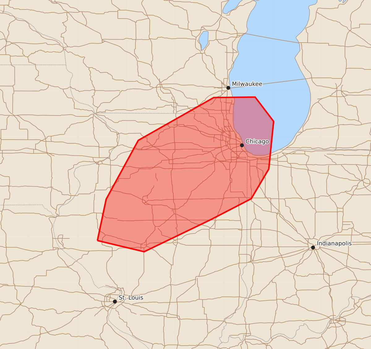
Summary
A tornado watch is in effect for central and northeast Illinois and far northwest Indiana through early evening, with the risk of intense tornadoes transitioning to a threat of damaging winds later tonight. Strong to intense tornadoes are expected during the next one to two hours, followed by a more widespread wind threat as storms mature.
Product Text
000 ACUS11 KWNS 112314 SWOMCD SPC MCD 112314 INZ000-ILZ000-WIZ000-120045- Mesoscale Discussion 1099 NWS Storm Prediction Center Norman OK 0614 PM CDT Thu Jun 11 2026 Areas affected...central into northeast Illinois into far northwest Indiana. Concerning...Tornado Watch 313... Valid 112314Z - 120045Z The severe weather threat for Tornado Watch 313 continues. SUMMARY...The tornado threat continues across watch 313 with an increasing damaging wind threat this evening. DISCUSSION...A broken line of storms has intensified along the front within the past hour. Expect this line to continue to intensify through the evening as the environment ahead of it continues to destabilize. The greatest threat for strong to intense tornadoes will likely be with the more discrete storms ahead of the line and within the break across north-central Illinois for the next 1 to 2 hours. By later this evening, the damaging wind threat will become more pronounced as this line of storms matures and expands and eventually overtakes the discrete storms. Some QLCS and embedded supercell tornado threat will exist within the line during the late evening, but tornado intensity should be less by that time. ..Bentley.. 06/11/2026 ...Please see www.spc.noaa.gov for graphic product... ATTN...WFO...LOT...ILX...MKX...LSX...DVN... LAT...LON 39899060 40749042 41958976 42838821 42848736 42348698 41368708 40758744 40328827 39668964 39899060 MOST PROBABLE PEAK TORNADO INTENSITY...140-170 MPH MOST PROBABLE PEAK WIND GUST...65-80 MPH MOST PROBABLE PEAK HAIL SIZE...1.00-1.75 IN