Mesoscale Discussion 1858
Issued: · Valid: –
Summary
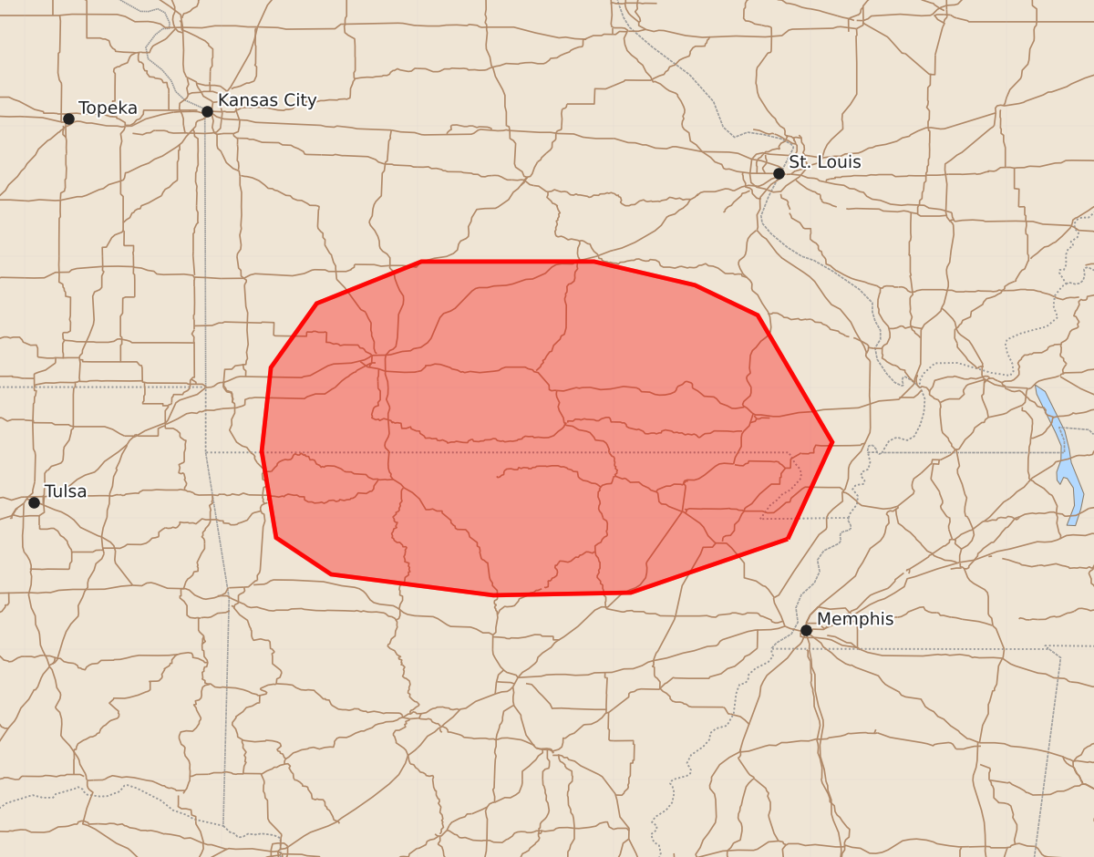
Isolated thunderstorms capable of producing large hail and damaging winds may occur across northern Arkansas and southern Missouri this evening.
Product Text
000 ACUS11 KWNS 080000 SWOMCD SPC MCD 072359 MOZ000-ARZ000-080130- Mesoscale Discussion 1858 NWS Storm Prediction Center Norman OK 0659 PM CDT Fri Aug 07 2026 Areas affected...northern Arkansas and southern Missouri Concerning...Severe potential...Watch unlikely Valid 072359Z - 080130Z Probability of Watch Issuance...5 percent SUMMARY...Thunderstorms will continue to be possible this evening across the area. The degree of instability will support at least an isolated potential for large hail and damaging winds. A watch is not anticipated. DISCUSSION...Satellite imagery and surface observations show a well-defined mesoscale convective vortex near Miller County, MO, moving east-southeast this evening. Isolated to scattered thunderstorms have developed along the periphery of this MCV, particularly to the south and east, where the environment is very unstable (MUCAPE values between 3000-4000 J/kg from SPC objective analysis). Modest surface convergence along various wind shift boundaries associated with the MCV will continue to provide foci for additional thunderstorm development this evening. Despite effective-layer shear remaining poor, the degree of instability, coupled with local augmentation of the kinematic environment due to the MCV, should result in at least some potential for large hail and damaging winds. A severe thunderstorm watch is not expected given the anticipated isolated nature of any severe potential. ..Marsh/Mosier.. 08/07/2026 ...Please see www.spc.noaa.gov for graphic product... ATTN...WFO...PAH...MEG...LSX...LZK...SGF...TSA... LAT...LON 35849017 35439137 35419242 35579366 35859408 36519419 37159412 37649377 37969297 37969165 37789088 37559040 36588983 35849017 MOST PROBABLE PEAK WIND GUST...UP TO 60 MPH MOST PROBABLE PEAK HAIL SIZE...UP TO 1.25 IN