Mesoscale Discussion 1215
Issued: · Valid: –
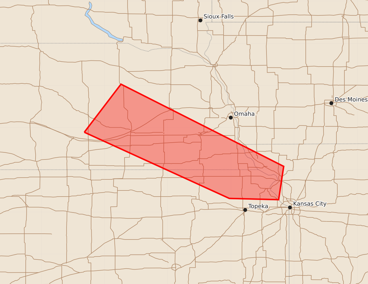
Summary
Severe thunderstorms capable of producing large hail and damaging wind gusts are moving through eastern Nebraska and into north-central and northeast Kansas this evening. These storms may bring wind gusts of 55 to 70 mph and hail up to 1.75 inches.
Product Text
000 ACUS11 KWNS 202346 SWOMCD SPC MCD 202345 MOZ000-KSZ000-NEZ000-IAZ000-210145- Mesoscale Discussion 1215 NWS Storm Prediction Center Norman OK 0645 PM CDT Sat Jun 20 2026 Areas affected...eastern Nebraska and north-central into northeast Kansas Concerning...Severe potential...Watch possible Valid 202345Z - 210145Z Probability of Watch Issuance...40 percent SUMMARY...Thunderstorms continue this evening across eastern Nebraska. These storms will pose the potential for gusty strong-to-severe winds and hail. The area is being monitored for a possible watch. DISCUSSION...Clusters of elevated thunderstorms continue to develop this afternoon across portions of eastern Nebraska as southwesterly moist warm-air advection in the 850-700 millibar layer continues into the region. Strongly veering-with-height wind profiles have resulted in effective-layer shear around 50 knots across the region, which has yielded thunderstorm organization, with overall storm motion to the southeast given the northwesterly mid-to-upper-level flow. Thermodynamically, the continued convection across eastern Nebraska is reinforcing a northwest-to-southeast surface boundary, which is effectively serving as a instability gradient. To the southwest of this boundary, MUCAPE between 2500-3000 J/kg exists, with MUCAPE quickly dropping off to less than 500 J/kg to the northeast. Two main areas to monitor have emerged over the past hour. The first is across southeast Nebraska where an elevated supercell has produced hail around 1" per a local storm report from WFO Omaha. This storm should continue to move east-southeast toward the greater Kansas City Metro. A secondary area is to the northwest, where several thunderstorms have organized into an elevated linear MCS that has produced reports of 60-70 mph wind gusts. This MCS will continue to track southeast. The region will be monitored for signs that the severe potential is evolving from largely independent, isolated occurrences to a more organized, sustained threat. If this evolution occurs, a watch may be necessary. ..Marsh/Smith.. 06/20/2026 ...Please see www.spc.noaa.gov for graphic product... ATTN...WFO...EAX...OAX...TOP...GID...LBF... LAT...LON 40899948 42039861 40089475 39299487 39329604 40899948 MOST PROBABLE PEAK WIND GUST...55-70 MPH MOST PROBABLE PEAK HAIL SIZE...1.00-1.75 IN