Mesoscale Discussion 2139
Issued: · Valid: –
Summary
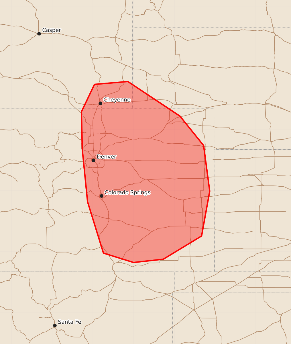
Severe storms capable of producing large hail up to two inches may develop this afternoon in southeast Wyoming, southwest Nebraska, and eastern Colorado. The threat of severe wind gusts up to 75 mph is expected to increase across these areas later this evening.
Product Text
000 ACUS11 KWNS 261944 SWOMCD SPC MCD 261943 COZ000-NEZ000-WYZ000-262215- Mesoscale Discussion 2139 NWS Storm Prediction Center Norman OK 0243 PM CDT Wed Aug 26 2026 Areas affected...southeast Wyoming...far southwest Nebraska Panhandle...and eastern Colorado Concerning...Severe potential...Watch possible Valid 261943Z - 262215Z Probability of Watch Issuance...60 percent SUMMARY...An initially isolated severe storm threat is expected to develop by mid to late afternoon, mainly in the form of large hail up to two inches. The potential for severe wind gusts up to 65-75 mph may increase this evening. A watch is possible by 21-22Z. DISCUSSION...Visible satellite and lightning data indicate deepening cumulus and early thunderstorm development from the Laramie Mountains to the Sangre de Cristo Range, as well as along a subtle boundary over east-central CO into northwest KS. The presence of steep low/mid-level lapse rates, surface dewpoints in the 50 to low 60s, and considerable daytime heating are contributing to a destabilizing air mass east of the mountains with MLCAPE expected to increase to 1500-2000 J/kg later this afternoon with minimal convective inhibition. As such, expect storms to gradually move off the high terrain with greater uncertainty in the evolving convection over east-central CO. The presence of 30-35 kt of deep-layer shear may support a few supercells capable of large hail up to two inches as the initial hazard. By this evening, there is some model signal for storms to merge into clusters, at which point the threat for severe winds with gusts up to 65-75 mph would increase. ..Mead/Mosier.. 08/26/2026 ...Please see www.spc.noaa.gov for graphic product... ATTN...WFO...GLD...PUB...BOU...CYS... LAT...LON 38720513 40010526 40930528 41600496 41670414 40820286 40100228 38980213 37880233 37310327 37230400 37460474 38720513 MOST PROBABLE PEAK WIND GUST...65-80 MPH MOST PROBABLE PEAK HAIL SIZE...1.50-2.50 IN