Mesoscale Discussion 1385
Issued: · Valid: –
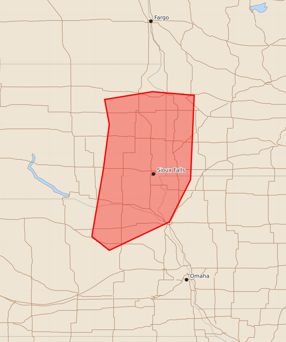
Summary
Severe thunderstorms capable of producing very large hail, damaging wind gusts over 75 mph, and a few tornadoes may develop across eastern South Dakota, southwest Minnesota, northeast Nebraska, and northwest Iowa this evening. These severe weather hazards are expected to increase in intensity between 4:00 PM and 7:30 PM CDT.
Product Text
000 ACUS11 KWNS 292100 SWOMCD SPC MCD 292100 MNZ000-IAZ000-NEZ000-SDZ000-292330- Mesoscale Discussion 1385 NWS Storm Prediction Center Norman OK 0400 PM CDT Mon Jun 29 2026 Areas affected...Eastern South Dakota...Southwest Minnesota...Northeast Nebraska...and far Northwest Iowa Concerning...Severe potential...Watch possible Valid 292100Z - 292330Z Probability of Watch Issuance...60 percent SUMMARY...Surface-based storm initiation will become increasingly likely in the 22-00Z time frame. Large to very large hail in excess of 2 inches and damaging winds with significant gusts of 75+ mph will be the predominant hazards. Observational data are being monitored for a possible watch issuance. DISCUSSION...The 18Z OAX sounding sampled a pronounced cap at the base of an EML, which has inhibited convective development along a cold front moving into the area from the west. However, latest CAM guidance suggests that isolated thunderstorm development is possible by as early as 22Z, but more likely closer to 00Z as continued daytime heating and the glancing influence of a short-wave trough to the west, locally erode the cap. Latest objective analysis indicates the air mass is strongly unstable with MLCAPE as high as 3000-4500+ J/kg. When coupled with 35-45 kt deep-layer shear, the setup appears supportive of supercells as the initial storm mode with the potential for large to very large hail. Later this evening into tonight, storms may begin to coalesce on growing cold pools, leading to a subsequent increase in damaging wind potential with significant gusts of 75+ mph possible. The greatest potential for a tornado or two will exist across eastern SD into western MN; however, the tendency for the low-level wind field to veer ahead of the cold front is expected to limit the overall threat. ..Mead/Guyer.. 06/29/2026 ...Please see www.spc.noaa.gov for graphic product... ATTN...WFO...MPX...FSD...OAX...ABR... LAT...LON 42189807 43649782 44639769 45179779 45349675 45269584 43429592 42509638 41889769 42189807 MOST PROBABLE PEAK TORNADO INTENSITY...UP TO 90 MPH MOST PROBABLE PEAK WIND GUST...65-80 MPH MOST PROBABLE PEAK HAIL SIZE...1.50-2.50 IN