Mesoscale Discussion 1143
Issued: · Valid: –
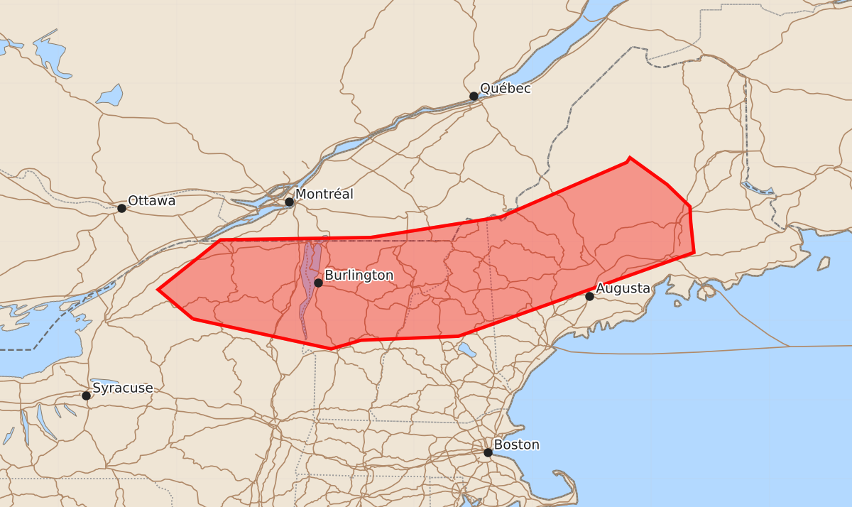
Summary
Scattered thunderstorms may produce strong wind gusts and marginal hail across portions of the Northeast, including parts of New York and Maine, this afternoon.
Product Text
000 ACUS11 KWNS 142020 SWOMCD SPC MCD 142020 MEZ000-NHZ000-VTZ000-NYZ000-142215- Mesoscale Discussion 1143 NWS Storm Prediction Center Norman OK 0320 PM CDT Sun Jun 14 2026 Areas affected...portions of the Northeast Concerning...Severe potential...Watch unlikely Valid 142020Z - 142215Z Probability of Watch Issuance...20 percent SUMMARY...A few stronger storms may produce strong to severe gusts and marginal hail this afternoon. DISCUSSION...Widely scattered shower and thunderstorm activity is ongoing across portions of the Northern Adirondacks in New York to Kennebec Valley in Maine. Through much of the morning and early afternoon, this area has been under mid-level cloud cover which has reduced daytime heating. As a result of this and ongoing showery activity, very marginal instability is in place. This is observed from the 18z ALB and GYX soundings. Though instability remains weak, deep layer shear around 40-45 kts may support a few stronger updrafts capable of strong to severe wind and marginally severe hail. Given the spatially limited nature of this risk, a watch is unlikely at this time. ..Thornton/Mosier.. 06/14/2026 ...Please see www.spc.noaa.gov for graphic product... ATTN...WFO...CAR...GYX...BTV...ALY... LAT...LON 44027480 44397524 45027445 45057255 45317090 46006931 46066927 45726880 45446851 45246850 44866846 43807144 43757267 43647305 44027480 MOST PROBABLE PEAK WIND GUST...UP TO 60 MPH MOST PROBABLE PEAK HAIL SIZE...UP TO 1.25 IN