Mesoscale Discussion 1386
Issued: · Valid: –
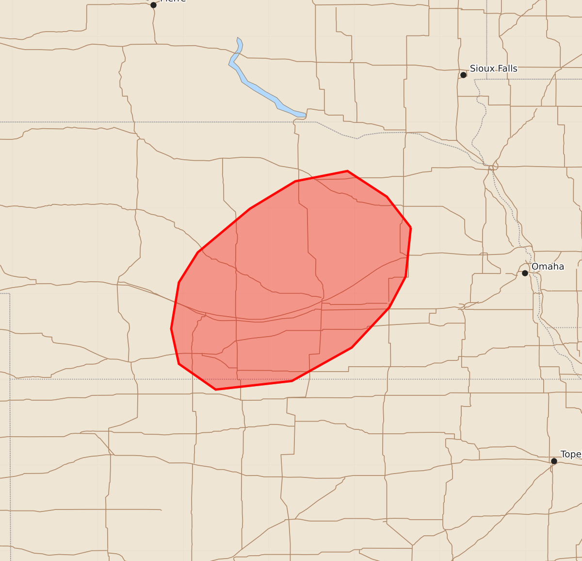
Summary
Strong to severe thunderstorms are expected to develop across portions of central and southern Nebraska this evening, bringing threats of large hail, damaging wind gusts, and possible tornadoes. These severe weather conditions are anticipated to occur over the next few hours.
Product Text
000 ACUS11 KWNS 292324 SWOMCD SPC MCD 292324 NEZ000-KSZ000-300100- Mesoscale Discussion 1386 NWS Storm Prediction Center Norman OK 0624 PM CDT Mon Jun 29 2026 Areas affected...portions of central/southern Nebraska Concerning...Severe potential...Severe Thunderstorm Watch likely Valid 292324Z - 300100Z Probability of Watch Issuance...80 percent SUMMARY...Strong to severe thunderstorm development is expected over the next 1-2 hours. A Severe Thunderstorm Watch will be needed. DISCUSSION...Latest visible satellite imagery depicts towering cumulus developing along a surface confluence zone in far northern Kansas. The glancing influence of a passing mid-level shortwave trough to the northwest and a strengthening southerly low-level jet are expected to continue to promote the erosion of convective inhibition (sampled by the 18z LBF observed sounding) and eventual convective initiation over the next 1-2 hours. Strong buoyancy and effective shear will promote supercells as the initial storm mode, with large to very large hail as the primary threat given steep mid-level lapse rates and elongated hodographs. With time, the gradual coalescence of cold pools should favor upscale growth, with an accompanying increase in the threat for severe wind gusts. While convection is expected to remain largely elevated owing to low-level stabilization with time, a tornado or two may also be possible where storms can remain/become surface-based. A Severe Thunderstorm Watch will be needed within the next hour to cover these threats. ..Chalmers/Thompson.. 06/29/2026 ...Please see www.spc.noaa.gov for graphic product... ATTN...WFO...OAX...GID...LBF...GLD... LAT...LON 41779734 41209740 40849759 40379803 39989873 39889962 40180005 40590014 41130005 41489983 41999922 42319869 42439808 42139762 41779734 MOST PROBABLE PEAK TORNADO INTENSITY...UP TO 90 MPH MOST PROBABLE PEAK WIND GUST...65-80 MPH MOST PROBABLE PEAK HAIL SIZE...1.50-2.50 IN