Watch 422 Outline
Issued:
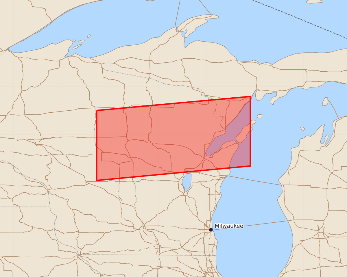
Summary
A severe thunderstorm watch is in effect for portions of northern Wisconsin and the Upper Peninsula of Michigan until 3:00 PM EDT. Expected hazards include large hail up to 2 inches and wind gusts of 60 knots.
Product Text
000 WWUS30 KWNS 301336 SAW2 SPC AWW 301336 WW 422 SEVERE TSTM MI WI LM 301340Z - 301900Z AXIS..50 STATUTE MILES NORTH AND SOUTH OF LINE.. 30W CWA/MOSINEE WI/ - 45S ESC/ESCANABA MI/ ..AVIATION COORDS.. 45NM N/S /52E EAU - 56ENE GRB/ HAIL SURFACE AND ALOFT..2 INCHES. WIND GUSTS..60 KNOTS. MAX TOPS TO 600. MEAN STORM MOTION VECTOR 23025. LAT...LON 45509028 45798710 44358710 44059028 THIS IS AN APPROXIMATION TO THE WATCH AREA. FOR A COMPLETE DEPICTION OF THE WATCH SEE WOUS64 KWNS FOR WOU2.