Day 3 Convective Outlook
Issued: · Valid: –
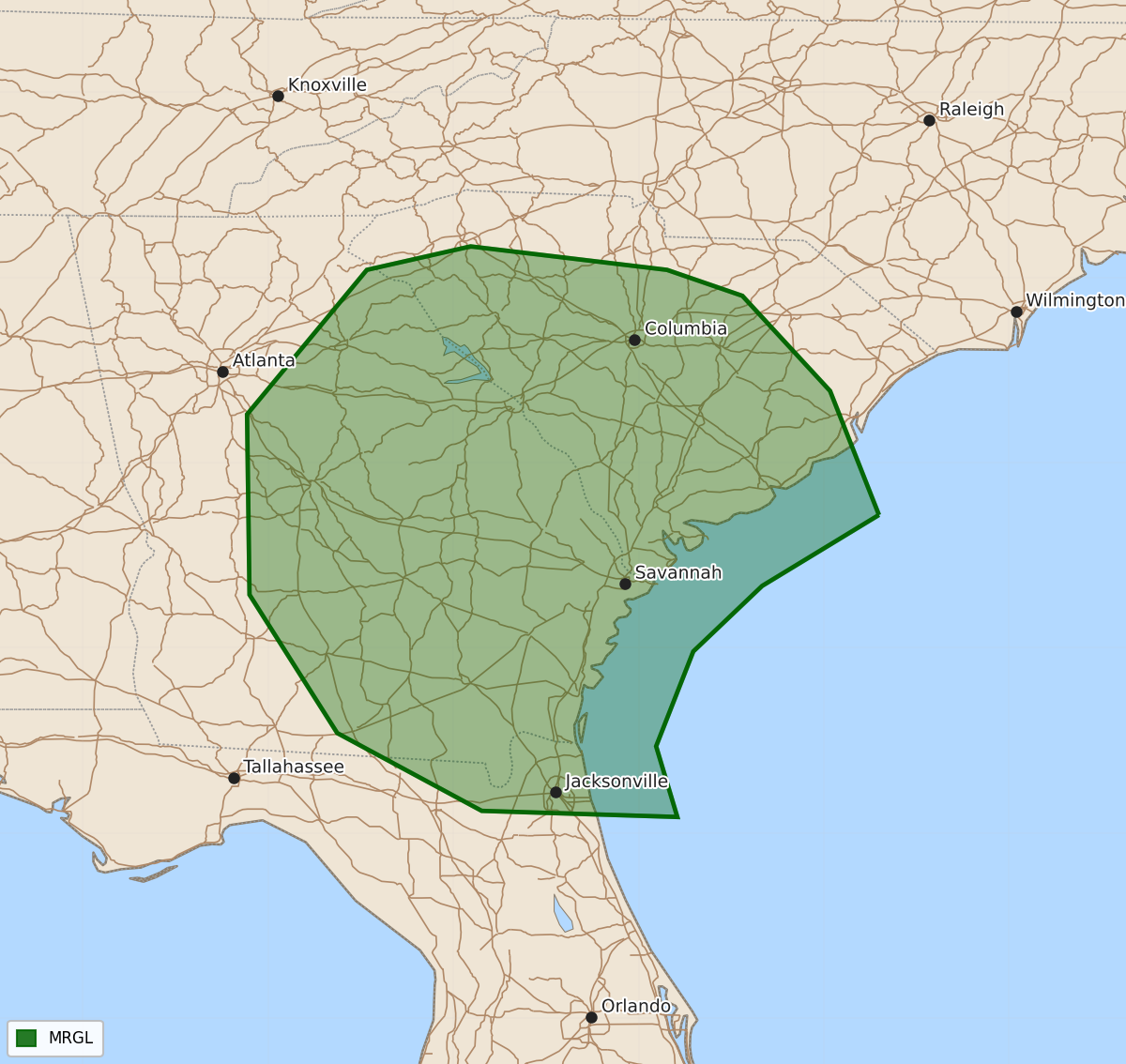
Summary
A few strong to severe thunderstorms are possible on Monday across portions of South Carolina, central Georgia, and far North Florida.
Product Text
000 ACUS03 KWNS 111933 SWODY3 SPC AC 111932 Day 3 Convective Outlook NWS Storm Prediction Center Norman OK 0232 PM CDT Sat Jul 11 2026 Valid 131200Z - 141200Z ...THERE IS A MARGINAL RISK OF SEVERE THUNDERSTORMS PORTIONS OF SOUTH CAROLINA INTO CENTRAL GEORGIA AND FAR NORTH FLORIDA... ...SUMMARY... A few strong-to-severe storms will be possible from South Carolina into central Georgia and far North Florida on Monday. ...Southeast... A weak, cut-off upper low will likely be present in the vicinity of the Tennessee Valley/southern Appalachians. This may help to organize storms along a stalled surface boundary within GA/SC. A moist airmass will promote a few stronger storms capable of wind damage. The overall threat does appear marginal as lapse rates will be less steep than previous days. ...Arizona... With at least 50s F dewpoints remaining within parts of Arizona, thunderstorm activity can again be expected during the afternoon. With mid-level flow being slightly more out of the southwest and weakening with time, it is not certain how strong storms will become and how many will move into the lower deserts. Even so, strong gusts will be possible given the inverted-v thermodynamic profiles. ...Southwest Montana... Models show a convective signal during the late afternoon within the higher terrain of southwest Montana. Due to cloud cover, buoyancy will not likely be very strong. Stronger flow aloft would allow for isolated, organized storms should heating be greater than forecast. ..Wendt.. 07/11/2026 $$