Mesoscale Discussion 1303
Issued: · Valid: –
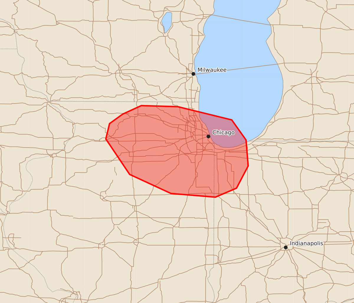
Summary
Severe thunderstorms capable of producing large hail, damaging winds, and a brief tornado are moving through portions of northeastern Illinois into northwestern Indiana. The severe threat is expected to gradually diminish over the next one to two hours.
Product Text
000 ACUS11 KWNS 250107 SWOMCD SPC MCD 250106 INZ000-ILZ000-250230- Mesoscale Discussion 1303 NWS Storm Prediction Center Norman OK 0806 PM CDT Wed Jun 24 2026 Areas affected...portions of northeastern Illinois into northwestern Indiana Concerning...Severe Thunderstorm Watch 387... Valid 250106Z - 250230Z The severe weather threat for Severe Thunderstorm Watch 387 continues. SUMMARY...The severe threat will gradually diminish over the next 1-2 hours. Isolated large hail, damaging wind gusts, and perhaps a brief tornado remain possible in the meantime. DISCUSSION...Scattered strong to severe thunderstorms remain ongoing across portions of northeastern Illinois and are beginning to spread into northwestern Indiana as of 0100 UTC. A mixed storm mode of supercells and clusters has produced sporadic large hail and damaging wind reports over the past 1-2 hours, and this threat is expected to persist east-southeastward into far northwestern Indiana, with isolated large hail, damaging wind gusts, and perhaps a brief tornado remaining possible. Objective analysis indicates that available buoyancy decreases rapidly with eastward extent, however. Coupled with the onset of low-level nocturnal cooling/stabilization and the eastward progression of the attendant mid-level shortwave trough, this will result in a gradually diminishing severe threat over the next couple of hours. A local watch extension could be needed should a stronger storm or two persist through the expiration time of Severe Thunderstorm Watch 387 at 0300 UTC, but additional watch issuance is not anticipated at this time. ..Chalmers.. 06/25/2026 ...Please see www.spc.noaa.gov for graphic product... ATTN...WFO...IWX...LOT...DVN... LAT...LON 42278925 42438890 42418821 42168719 41788692 41298688 40878710 40708750 40778834 41138912 41808957 42098950 42278925 MOST PROBABLE PEAK TORNADO INTENSITY...UP TO 90 MPH MOST PROBABLE PEAK WIND GUST...UP TO 60 MPH MOST PROBABLE PEAK HAIL SIZE...UP TO 1.25 IN