Mesoscale Discussion 1674
Issued: · Valid: –
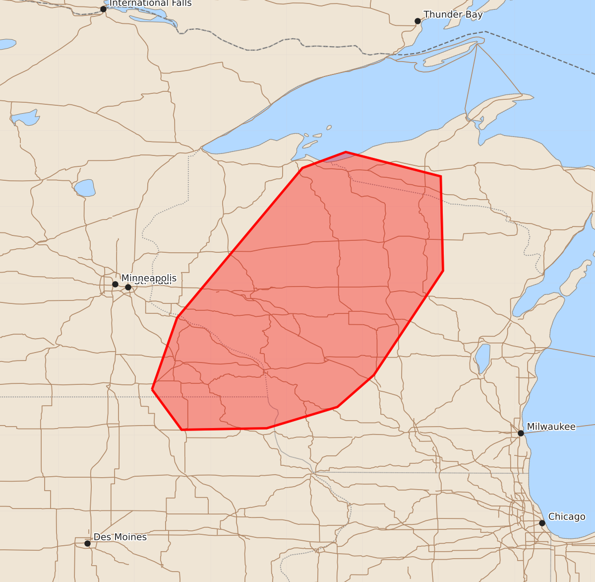
Summary
Severe storms capable of producing tornadoes, large hail, and damaging winds are expected to develop across northeast Iowa and northwest/north-central Wisconsin late this afternoon. A tornado watch is likely for these areas as supercells potentially bring significant severe weather.
Product Text
000 ACUS11 KWNS 201853 SWOMCD SPC MCD 201853 MIZ000-WIZ000-IAZ000-MNZ000-202100- Mesoscale Discussion 1674 NWS Storm Prediction Center Norman OK 0153 PM CDT Mon Jul 20 2026 Areas affected...Northeast Iowa into northwest/north-central Wisconsin Concerning...Severe potential...Tornado Watch likely Valid 201853Z - 202100Z Probability of Watch Issuance...95 percent SUMMARY...All severe hazards, including some significant, are possible as supercells develop by late afternoon. Timing and location of initiation are the main uncertainties. A tornado watch is likely. DISCUSSION...A very moist airmass is evident ahead of a cold front in the Upper Mississippi Valley. A capping inversion was present on the 12Z MPX observed sounding. Cumulus along the front have yet to become vertically developed as a result. Mid-level convection has been ongoing in southern Minnesota. This activity is now moving into modifying outflow from an earlier MCS in the La Crosse/Davenport vicinity. Lift from a shortwave trough in northern Minnesota will continue to overspread the area this afternoon. With time, continued heating and moistening ahead of the cold front and near the outflow front intersection should allow storms to develop, most likely by late afternoon. Given strong shear (50-60 kt effective) across the cold front, supercell structures will be favored. Steep mid-level lapse rates will support the threat for large to very-large hail. A tornado threat, some possibly strong, will also be present with supercells. Severe winds will also be possible. Wind gusts of 75+ mph are possible, particularly where activity grows upscale. The exact timing/location of storm initiation is not clear though a tornado watch is likely. ..Wendt/Thompson.. 07/20/2026 ...Please see www.spc.noaa.gov for graphic product... ATTN...WFO...MQT...GRB...MKX...DLH...ARX...MPX... LAT...LON 43609277 44549244 46519079 46729022 46408897 45168894 43798985 43379033 43099126 43079238 43609277 MOST PROBABLE PEAK TORNADO INTENSITY...120-145 MPH MOST PROBABLE PEAK WIND GUST...65-80 MPH MOST PROBABLE PEAK HAIL SIZE...1.50-2.50 IN