Mesoscale Discussion 1625
Issued: · Valid: –
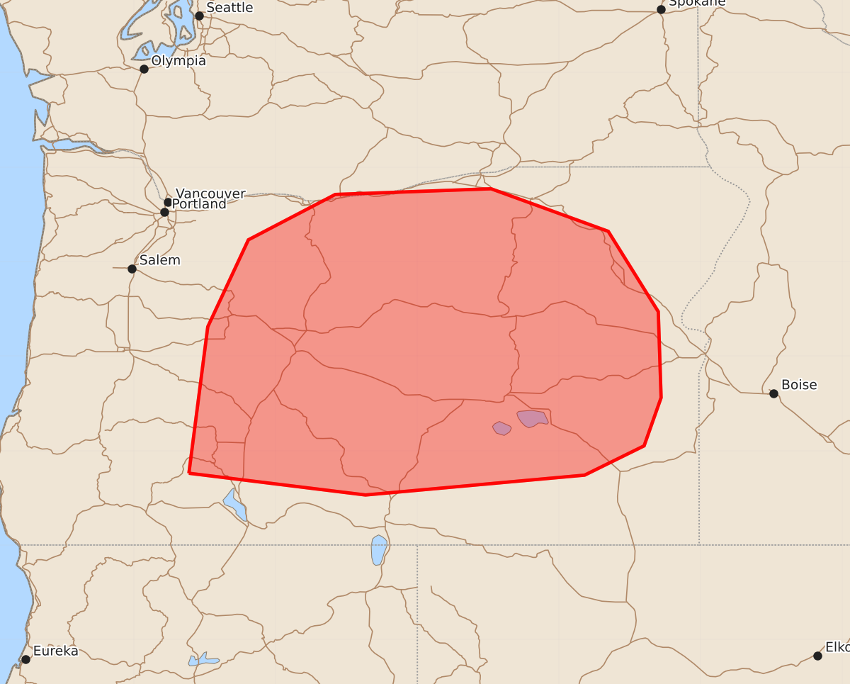
Summary
Isolated strong to severe wind gusts are possible across much of central and eastern Oregon through the afternoon and evening of July 15, 2026. These wind gusts are expected to reach speeds of 55 to 70 mph during thunderstorms.
Product Text
000 ACUS11 KWNS 151932 SWOMCD SPC MCD 151931 ORZ000-WAZ000-152100- Mesoscale Discussion 1625 NWS Storm Prediction Center Norman OK 0231 PM CDT Wed Jul 15 2026 Areas affected...much of central and eastern Oregon Concerning...Severe potential...Watch unlikely Valid 151931Z - 152100Z Probability of Watch Issuance...20 percent SUMMARY...A few strong to severe gusts may accompany the stronger storms through the afternoon and evening hours. The severe threat should remain isolated, with a WW issuance not expected. DISCUSSION...Widely scattered thunderstorms have recently initiated atop a well-mixed boundary layer extending up to 600 mb per RAP forecast soundings. Furthermore, surface observations show 30+ T/Td spreads across much of OR, especially east of the Cascades, indicative of efficient evaporative cooling potential for downbursts. An upper-level south-southwesterly wind maximum is overspreading this boundary layer, resulting in elongated hodographs (speed shear) and over 35 kts of effective bulk shear. This vertical wind shear, and evaporative cooling potential (evident via 1000-1500 J/kg DCAPE), may support strong to severe wind gusts with the stronger pulse-cellular/multicellular storms. Nonetheless, the severe threat should remain quite isolated, precluding a Severe Thunderstorm Watch. ..Squitieri/Mosier.. 07/15/2026 ...Please see www.spc.noaa.gov for graphic product... ATTN...WFO...BOI...PDT...MFR...PQR... LAT...LON 42762242 44312222 45232179 45712087 45771922 45321798 44471745 43561742 43051760 42741823 42532055 42762242 MOST PROBABLE PEAK WIND GUST...55-70 MPH