Mesoscale Discussion 1413
Issued: · Valid: –
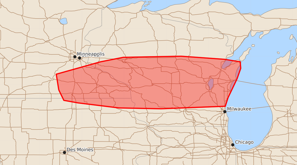
Summary
Strong to locally severe storms capable of producing damaging winds and hail are possible across southeast Minnesota, northeast Iowa, and central to southern Wisconsin through the morning.
Product Text
000 ACUS11 KWNS 011159 SWOMCD SPC MCD 011159 WIZ000-IAZ000-MNZ000-011430- Mesoscale Discussion 1413 NWS Storm Prediction Center Norman OK 0659 AM CDT Wed Jul 01 2026 Areas affected...Southeast MN and extreme northeast IA into central/southern WI Concerning...Severe potential...Watch possible Valid 011159Z - 011430Z Probability of Watch Issuance...40 percent SUMMARY...Strong to locally severe storms are possible through the morning. DISCUSSION...At 1155 UTC, a small, forward-propagating storm cluster is moving across central WI. This cluster is moving through an axis of rich boundary-layer moisture, with mid 70s F dewpoints supporting MLCAPE of greater than 2000 J/kg, per recent objective mesoanalyses. 30-40 kt is sufficient for continued storm organization, and this cluster will continue to pose a short-term threat of at least locally damaging wind. Early visible imagery depicts relatively clear skies and some potential for diurnal heating across eastern WI in advance of this cluster. As a result, this cluster may persist through the morning and eventually approach Lake Michigan, though its longevity remains somewhat uncertain due to generally modest large-scale ascent. Farther west, extensive convection is ongoing within a warm-advection regime across southern MN. Occasionally organized storms may continue to develop within this regime, and pose a short-term threat for isolated hail and damaging wind. Farther west, multiple MCVs are noted from northern NE into northeast SD. Increasing flow in the 700-500 mb layer (as depicted in short-term guidance) associated with these MCVs may allow for some uptick in storm organization and longevity later this morning, near and just north of an outflow-influenced front draped from southern MN into central WI. While timing of a more substantial severe threat remains uncertain, watch issuance is possible later this morning if trends support an increasing coverage and duration of organized storms. ..Dean/Smith.. 07/01/2026 ...Please see www.spc.noaa.gov for graphic product... ATTN...WFO...GRB...MKX...ARX...MPX...DMX... LAT...LON 43809382 44369391 44809234 44969153 45008947 44898793 44808737 44578735 44208748 43788768 43538780 43228790 43139019 43169168 43349314 43439364 43809382 MOST PROBABLE PEAK TORNADO INTENSITY...UP TO 90 MPH MOST PROBABLE PEAK WIND GUST...55-70 MPH MOST PROBABLE PEAK HAIL SIZE...UP TO 1.25 IN