Mesoscale Discussion 1690
Issued: · Valid: –
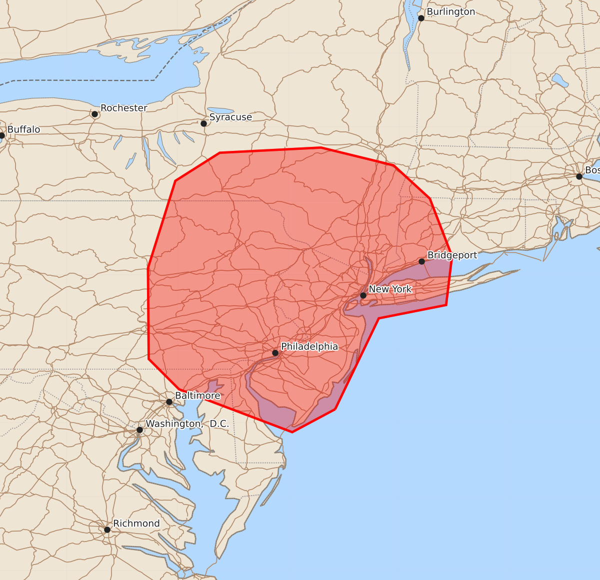
Summary
Severe thunderstorms capable of producing damaging winds, large hail, and tornadoes are expected to develop across portions of the Mid-Atlantic and Northeast this afternoon. The most significant threats are centered over southeast Pennsylvania and New Jersey, with the potential to expand into southeast New York and Connecticut.
Product Text
000 ACUS11 KWNS 211724 SWOMCD SPC MCD 211723 NYZ000-CTZ000-MAZ000-NJZ000-PAZ000-DEZ000-MDZ000-211930- Mesoscale Discussion 1690 NWS Storm Prediction Center Norman OK 1223 PM CDT Tue Jul 21 2026 Areas affected...portions of the Mid-Atlantic into the Northeast Concerning...Severe potential...Watch likely Valid 211723Z - 211930Z Probability of Watch Issuance...80 percent SUMMARY...Increasing storm coverage is expected through the afternoon and will necessitate a watch. DISCUSSION...Recent composite radar indicates increasing shower and thunderstorm coverage across eastern Pennsylvania on the leading edge of mid 70s dewpoints as they advect northward. Most of this activity is moving away from the greater moisture/instability, but continued northward destabilization is anticipated. In addition, broken cloud cover across southeast Pennsylvania and New Jersey will result in greater instability within this zone. The leading edge of a 50 knot mid-level jet (centered around 5-6km) has been sampled by the CCX VWP within the last half an hour. As this overspreads the warm sector, shear will be in place for storm organization, including supercells. Damaging winds will be the primary threat, but some large hail and a few tornadoes will also be possible. The greatest threat will be across southeast Pennsylvania and New Jersey, where the greater instability is in place. However, as the warm front lifts northeastward, the threat could extend into southeast New York and Connecticut this afternoon. ..Bentley/Mosier.. 07/21/2026 ...Please see www.spc.noaa.gov for graphic product... ATTN...WFO...BOX...OKX...ALY...PHI...BGM...CTP...LWX... LAT...LON 39187437 38877495 39457648 39867689 41097690 42277653 42657593 42727456 42487358 42037309 41257279 40597287 40417378 39187437 MOST PROBABLE PEAK TORNADO INTENSITY...85-110 MPH MOST PROBABLE PEAK WIND GUST...55-70 MPH MOST PROBABLE PEAK HAIL SIZE...1.00-1.75 IN