Mesoscale Discussion 1115
Issued: · Valid: –
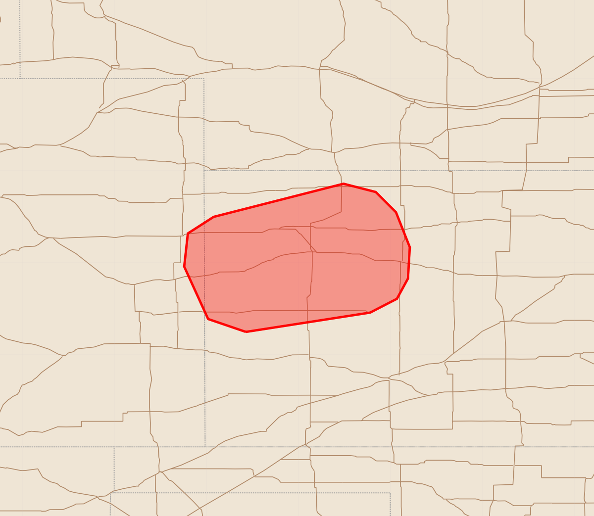
Summary
Isolated large hail is expected across western Kansas and far east-central Colorado over the next few hours. The severity of this threat is localized, with potential hail sizes reaching up to 1.75 inches.
Product Text
000 ACUS11 KWNS 130412 SWOMCD SPC MCD 130412 KSZ000-COZ000-130615- Mesoscale Discussion 1115 NWS Storm Prediction Center Norman OK 1112 PM CDT Fri Jun 12 2026 Areas affected...Western Kansas and far east-central Colorado Concerning...Severe potential...Watch unlikely Valid 130412Z - 130615Z Probability of Watch Issuance...20 percent SUMMARY...A localized hail threat may persist for the next few hours across western Kansas and perhaps far east-central Colorado. This threat is expected to remain fairly spatially confined and isolated; watch issuance will likely not be needed. DISCUSSION...Convection across western Kansas has been monitored over the past couple of hours. An initially discrete cell briefly intensified and produced golf-ball sized hail before dissipating, though more recently additional convection has materialized and continues to intensify. The structure and propagation of these cells strongly suggests that they are being driven by low-level isentropic ascent as the nocturnal jet continues to intensify (per regional VWPs). Recent forecast soundings hint that this convection is likely rooted between 1-3 km AGL and is realizing the 2000-2500 J/kg MUCAPE in place across western KS. Effective shear within the model-depicted CAPE-bearing layer is likely around 50-60 knots, which is more than sufficient for organized cells capable of producing instances of large hail up to at least 1.75 inches (based on observed hail from the initial cell). RAP mesoanalyses suggest that the MUCAPE plume is fairly narrow and confined mainly to western KS. The demise of prior convection with eastward extent seems to confirm these analyses. Consequently, the severe hail threat will likely be spatially limited. However, GOES IR imagery shows some percolating cumulus to the west of the ongoing cells, hinting that additional, but isolated, convection is possible over the next few hours. Given the isolated nature of the threat, watch issuance is currently not anticipated. ..Moore/Gleason.. 06/13/2026 ...Please see www.spc.noaa.gov for graphic product... ATTN...WFO...DDC...GLD...PUB... LAT...LON 38250157 38390198 38960224 39320220 39500192 39860051 39770016 39559994 39179979 38839981 38619993 38460022 38250157 MOST PROBABLE PEAK WIND GUST...UP TO 60 MPH MOST PROBABLE PEAK HAIL SIZE...1.00-1.75 IN