Day 1 Convective Outlook
Issued: · Valid: –
Summary
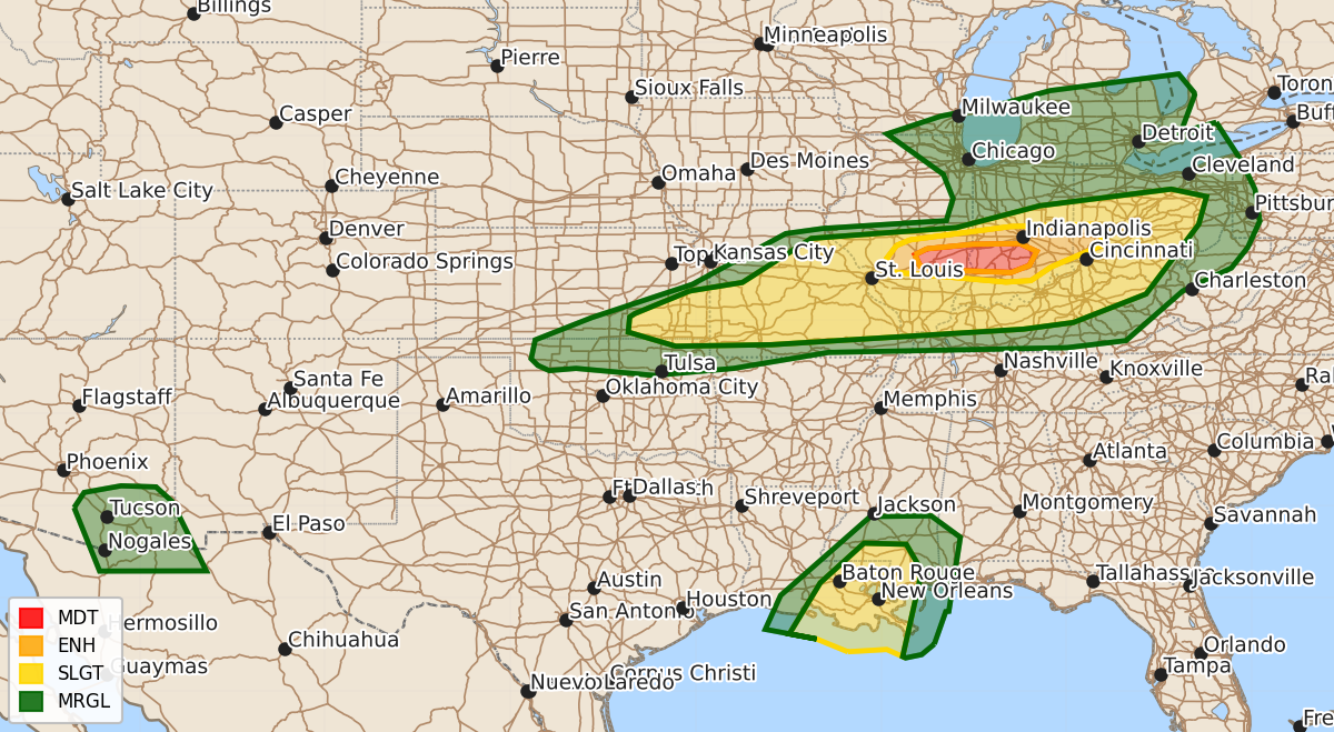
A corridor of tornadoes, damaging hail, and wind is expected across south-central Illinois and into Indiana this evening, with a threat of strong tornadoes possible. Severe hail and wind are also expected from southeast Kansas to western Ohio, while the Northern Gulf Coast faces potential tornadoes and severe hail tonight.
Product Text
000 ACUS01 KWNS 180112 SWODY1 SPC AC 180110 Day 1 Convective Outlook NWS Storm Prediction Center Norman OK 0810 PM CDT Wed Jun 17 2026 Valid 180100Z - 181200Z ...THERE IS A MODERATE RISK OF SEVERE THUNDERSTORMS SOUTH-CENTRAL PORTIONS OF ILLINOIS AND INDIANA... ...THERE IS A SLIGHT RISK OF SEVERE THUNDERSTORMS ALONG THE NORTHERN GULF COAST... ...SUMMARY... A corridor of tornado, damaging hail and wind threat persists from south-central Illinois into Indiana this evening. A broader zone of severe hail and wind extends from southeast Kansas into western Ohio. ...IL...IN...MO...OH... The greatest tornado threat corridor extends from south-central IL into parts of central/southwest IN this evening, where air mass recovery continues out of the southwest. Supercells in this region have been tornadic at times, also producing large damaging hail. Given the extreme shear downstream, and continued low-level theta-advection, the environment remains conditionally favorable for a couple strong tornadoes through this evening over a small portion of IL and IN. The threat may extend as far east as western/central OH later tonight, with tornado potential depending on instability. For more information see mesoscale discussion 1171. ...Northern Gulf Coast... A moist and unstable environment exists across LA and into southern MS/AL ahead of Arthur. Low-level shear may increase further this evening, with periodic mini-supercell potential and tornado risk. For more information see mesoscale discussion 1172. ..Jewell.. 06/18/2026 $$