Mesoscale Discussion 1220
Issued: · Valid: –
Summary
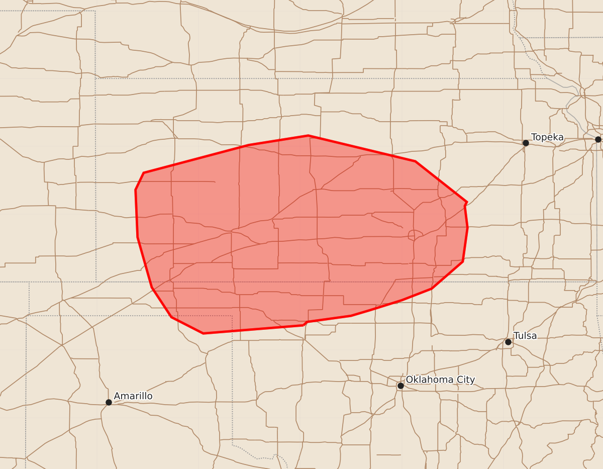
Severe thunderstorms capable of producing damaging wind gusts and large hail are possible for portions of west-central to southern Kansas, the extreme northeastern Texas Panhandle, and far northern Oklahoma late tonight.
Product Text
000 ACUS11 KWNS 210243 SWOMCD SPC MCD 210242 KSZ000-OKZ000-TXZ000-210345- Mesoscale Discussion 1220 NWS Storm Prediction Center Norman OK 0942 PM CDT Sat Jun 20 2026 Areas affected...portions of west-central into southern Kansas...the extreme northeastern Texas Panhandle...and far northern Oklahoma Concerning...Severe potential...Watch possible Valid 210242Z - 210345Z Probability of Watch Issuance...60 percent SUMMARY...A downstream Severe Thunderstorm Watch issuance is being considered. DISCUSSION...A mature cold-pool-driven MCS continues to produce measured severe gusts across western KS. Both NEXRAD single-site and MRMS mosaic radar data have shown an uptick in the organization and intensity of the MCS, with a somewhat increased southeasterly propagation speed and a well defined rear inflow jet. Given residual 1500-3000 J/kg MLCAPE and 40-50 kts of effective bulk shear ahead of this MCS, it is plausible that the accompanying wind swath may potentially cross into far northern OK. As such, a downstream Severe Thunderstorm Watch issuance will probably be needed given a persisting strong MCS structure with accompanying measured severe gusts. ..Squitieri/Smith.. 06/21/2026 ...Please see www.spc.noaa.gov for graphic product... ATTN...WFO...TOP...ICT...OUN...GID...DDC...GLD...AMA... LAT...LON 36369895 36240043 36480090 36920119 37660140 38360143 38610131 39029976 39169888 38789730 38189654 38129657 37809653 37309660 36909706 36739750 36589798 36509825 36419890 36369895 MOST PROBABLE PEAK TORNADO INTENSITY...UP TO 90 MPH MOST PROBABLE PEAK WIND GUST...65-80 MPH MOST PROBABLE PEAK HAIL SIZE...1.50-2.50 IN