Mesoscale Discussion 1869
Issued: · Valid: –
Summary
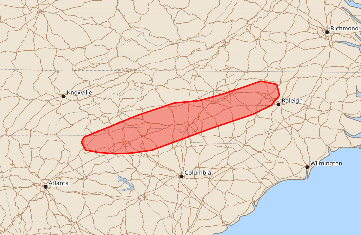
Sporadic damaging winds of up to 60 mph are possible across parts of South Carolina and western and central North Carolina through the next couple of hours.
Product Text
000 ACUS11 KWNS 082211 SWOMCD SPC MCD 082210 NCZ000-SCZ000-GAZ000-090015- Mesoscale Discussion 1869 NWS Storm Prediction Center Norman OK 0510 PM CDT Sat Aug 08 2026 Areas affected...Portions of the Carolinas Concerning...Severe potential...Watch unlikely Valid 082210Z - 090015Z Probability of Watch Issuance...5 percent SUMMARY...Sporadic damaging winds will be possible for the next couple of hours across parts of South Carolina and western/central North Carolina. Watch issuance is not expected. DISCUSSION...Thunderstorms have been slowly intensifying along the Appalachians over the past 2-3 hours per regional radar imagery and lightning trends. More recently, much of this activity has exhibited strong outflow - a manifestation of the poor kinematic environment (also confirmed by regional VWPs). Furthermore, west/southwesterly mid-level flow is favoring storm motions along the zone of ascent, which is limiting southeastward propagation into a more deeply-mixed and buoyant air mass (characterized by 0-3 km lapse rates near 8 C/km and around 1000 J/kg MLCAPE). Nonetheless, some degree of storm propagation into the well-mixed/buoyant air is probable as outflows surge south/southeastward and collide. Convection developing within this regime will be capable of produce strong downbursts with embedded swaths of damaging winds (most likely 45-60 mph). Confidence in the coverage and/or duration of intense convection is very limited and precludes watch issuance, but a few instances of wind damage appear possible over the next couple of hours prior to the onset of nocturnal cooling after 00 UTC. ..Moore/Mosier.. 08/08/2026 ...Please see www.spc.noaa.gov for graphic product... ATTN...WFO...RAH...RNK...CAE...GSP... LAT...LON 34968342 35508210 35808121 35868059 36018005 36197951 36347908 36267869 35997862 35757882 35527928 35198026 34648175 34578223 34558264 34588304 34648338 34838348 34968342 MOST PROBABLE PEAK WIND GUST...UP TO 60 MPH