Mesoscale Discussion 1446
Issued: · Valid: –
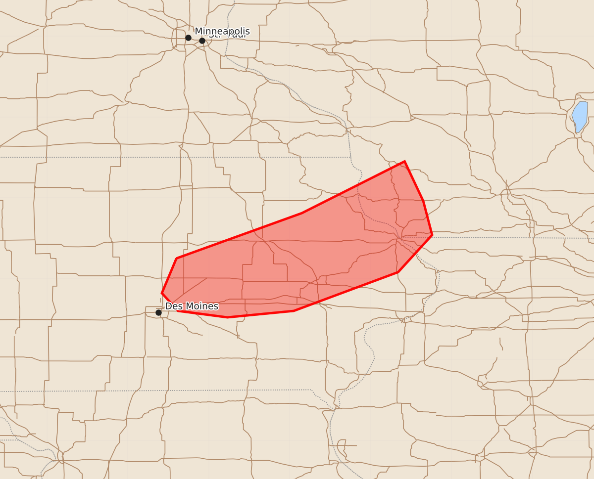
Summary
A cluster of supercells will bring large hail and severe wind gusts to central and northeast Iowa from late this afternoon through the evening. These storms are expected to produce wind gusts up to 70 mph and hail as large as 1.25 inches.
Product Text
000 ACUS11 KWNS 022053 SWOMCD SPC MCD 022053 WIZ000-ILZ000-IAZ000-022230- Mesoscale Discussion 1446 NWS Storm Prediction Center Norman OK 0353 PM CDT Thu Jul 02 2026 Areas affected...central to northeast Iowa Concerning...Severe Thunderstorm Watch 437... Valid 022053Z - 022230Z The severe weather threat for Severe Thunderstorm Watch 437 continues. SUMMARY...A cluster of supercells across northeast Iowa will continue this afternoon and into the evening. DISCUSSION...Scattered large hail and wind gusts have been reported across northeast Iowa this afternoon with a cluster of supercells. Additional development continues on the southwest flank where dewpoints are in the mid 70s with temperatures near 90 F, yielding MLCAPE near 3000 J/kg per SPC mesoanalysis. Mid-level flow around 40 to 45 knots (sampled by the KDMX VWP) is supporting supercell structures and will continue to assist in updraft rotation this afternoon and evening. The orientation of the storms and updraft collisions may limit the overall severe threat somewhat. However, the environment will continue to support large hail and severe wind gusts late this afternoon and into the evening. ..Bentley.. 07/02/2026 ...Please see www.spc.noaa.gov for graphic product... ATTN...WFO...MKX...DVN...ARX...DMX... LAT...LON 42259340 42819185 43459058 42969035 42549024 42089066 41609195 41529277 41609338 41829358 42259340 MOST PROBABLE PEAK TORNADO INTENSITY...UP TO 90 MPH MOST PROBABLE PEAK WIND GUST...55-70 MPH MOST PROBABLE PEAK HAIL SIZE...UP TO 1.25 IN