Day 3 Convective Outlook
This product has been superseded. View the updated product →
Issued: · Valid: –
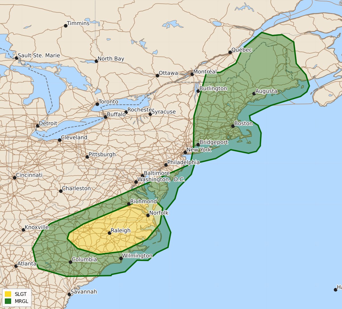
Summary
Isolated strong to severe thunderstorms capable of producing damaging wind gusts are expected across portions of southeast Virginia and North Carolina on Wednesday.
Product Text
000 ACUS03 KWNS 200722 SWODY3 SPC AC 200721 Day 3 Convective Outlook NWS Storm Prediction Center Norman OK 0221 AM CDT Mon Jul 20 2026 Valid 221200Z - 231200Z ...THERE IS A SLIGHT RISK OF SEVERE THUNDERSTORMS ACROSS PORTIONS OF NORTH CAROLINA INTO SOUTHEAST VIRGINIA... ...SUMMARY... Isolated strong to severe thunderstorms will pose a risk for damaging wind gusts across parts of southeast Virginia and North Carolina. ...Mid-Atlantic to New England... Several shortwave impulses will migrate through persistent upper troughing over the East on Wednesday. At the surface, low pressure will lift northeast across Quebec. A trailing cold front will move east/southeast across portions of the region, become positioned from the Mid-Atlantic coast into central NC by Thursday morning. Southerly low-level flow ahead of the front will maintain a seasonally moist airmass. Moderate destabilization is expected across parts of the Mid-Atlantic into NC where boundary-layer moisture is greater and stronger heating may occur. Weak instability will be located over New England. Around 30-40 kt southwesterly flow from 850-500 mb will provide sufficient vertical shear for some organized cells/clusters. Isolated strong to severe storms producing damaging winds are expected across portions of the Mid-Atlantic into New England, with the greatest risk across parts of VA/NC and vicinity. ..Leitman.. 07/20/2026 $$