Day 3 Convective Outlook
Issued: · Valid: –
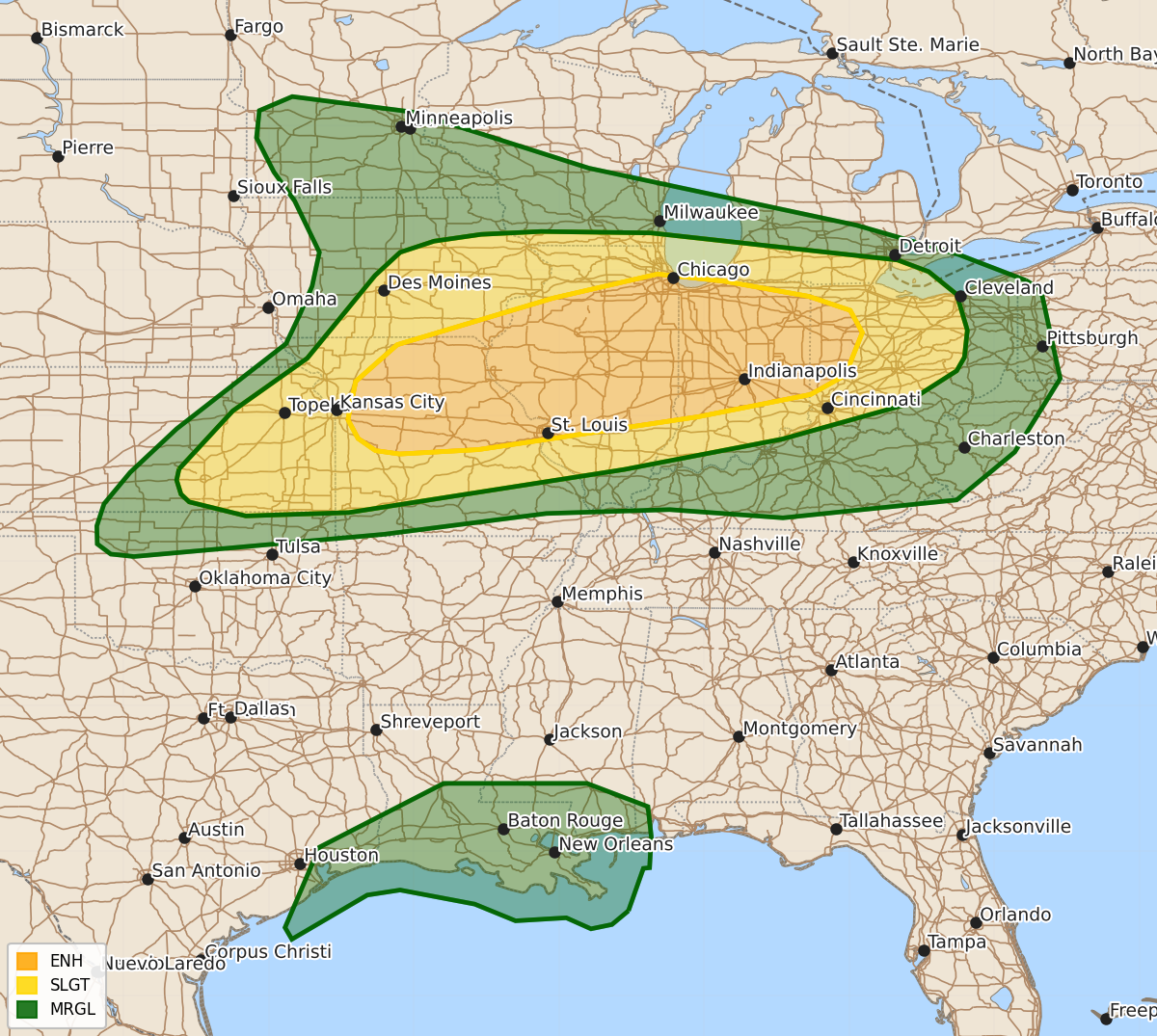
Summary
Severe thunderstorms capable of producing strong tornadoes, very large hail, and damaging winds are expected across portions of the Middle Mississippi Valley, Indiana, and western Ohio on Wednesday. These intense storms may occur in multiple rounds throughout the day and evening.
Product Text
000 ACUS03 KWNS 151932 SWODY3 SPC AC 151931 Day 3 Convective Outlook NWS Storm Prediction Center Norman OK 0231 PM CDT Mon Jun 15 2026 Valid 171200Z - 181200Z ...THERE IS AN ENHANCED RISK OF SEVERE THUNDERSTORMS ACROSS PORTIONS OF THE MID-MISSISSIPPI VALLEY INTO INDIANA AND WESTERN OHIO.... ...SUMMARY... An all-hazards severe thunderstorm event is expected across portions of the Middle Mississippi Valley into Indiana on Wednesday. Intense thunderstorms may produce swaths of damaging wind, as well as strong tornadoes and very large hail. ...Synopsis... A strong mid-level jet will extend from the Northwest to the Ohio Valley. An embedded 75 to 85 knot mid-level shortwave trough will extend from Nebraska into Iowa by Wednesday afternoon. A strong surface cyclone will move from eastern South Dakota to southern Ontario during the period. ...Midwest... Elevated supercells will likely be ongoing at the beginning of the period across central/eastern Iowa at the nose of the low-level jet. This cluster will continue to move east-southeast along/north of the warm front through the day. This activity will likely have some hail threat through the day with at least some tornado threat on the southern periphery if any storms can latch onto the warm front. Strong lower tropospheric flow should result in rapid recovery/destabilization in the wake of these morning storms across central/northern Illinois. A very favorable kinematic environment will be in place with 70 knots of mid-level flow and 100+ knots of upper-level flow with a 60+ knot low-level jet. Therefore, any storms which develop within this zone could have a threat for very large hail, and strong tornadoes. Due to this morning convection, there is considerable uncertainty exactly where this most favorable environment may set up and how broad of a region it will be. Notably, strong isentropic ascent is forecast along the frontal zone through the entire period which could result in continued development along the warm frontal zone (more widespread than currently depicted by guidance) and a limited window for recovery in the wake of the morning storms. Despite these uncertainties, have upgraded severe probabilities to 45% in the region where multiple rounds of severe weather appear most likely. Conceptually, the 12Z RRFS solution matches a reasonable solution with a morning cluster of supercells including a severe supercell on the southern extent. Additional supercells developing along the trailing outflow/warm front during the afternoon, followed by supercells developing along the cold front by late afternoon. Even if storm development north of the warm front is quite extensive during the day, forecast soundings show a Bunkers storm motion parallel to the expected front/outflow orientation. This points toward a favorable environment for one or more supercells to move along the boundary in a favorable tornadic environment. Widespread storm development is expected along the cold front by late afternoon from southeast Iowa to far eastern Kansas. Very strong instability and moderate to strong shear will support supercells capable of large to very large hail. In addition, strong low-level shear will support the potential for strong tornadoes. There is some question regarding storm mode along the front. Strong forcing would favor more storm interaction and upscale growth, but fast storm motions (40-50 knots) and a Bunkers RM motion nearly perpendicular to the front may support maintenance of supercell mode at least within some areas along the front. This would support a greater tornado threat during the evening from north-central Missouri to central Illinois. If storms do grow more upscale early in the lifecycle, the tornado/hail threat would be reduced, but the threat for significant wind gusts would increase substantially. ...Gulf Coast... A Marginal Risk has been added along the Gulf as a tropical airmass moves inland with a strengthening wind field associated with the tropical disturbance identified by the NHC. ..Bentley.. 06/15/2026 $$