Day 1 Convective Outlook
This product has been superseded. View the updated product →
Issued: · Valid: –
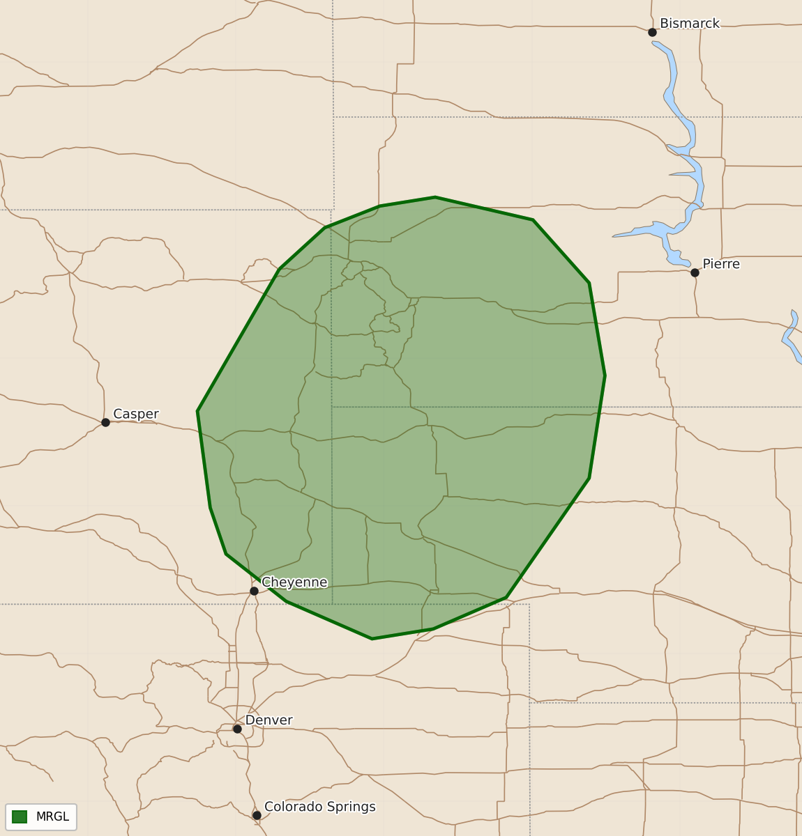
Summary
Isolated thunderstorms capable of producing large hail are possible across portions of western Nebraska and the Black Hills of South Dakota this afternoon and evening.
Product Text
000 ACUS01 KWNS 271232 SWODY1 SPC AC 271230 Day 1 Convective Outlook NWS Storm Prediction Center Norman OK 0730 AM CDT Sun Sep 27 2026 Valid 271300Z - 281200Z ...THERE IS A MARGINAL RISK OF SEVERE THUNDERSTORMS FOR PORTIONS OF THE CENTRAL AND NORTHERN HIGH PLAINS... ...SUMMARY... Isolated thunderstorms capable of large hail will be possible across portions of western Nebraska and the Black Hills of South Dakota. ...Portions of the Central and Northern High Plains ... A residual moist axis over the Plains will feature 60s deg F surface dewpoints extending from the southern Plains northward into NE/SD. The western periphery of the moist plume will undergo strong heating despite some increasing high cloud cover. Forcing will likely remain negligible through the day and limit storm coverage with moderate buoyancy developing in western NE. During the evening, thunderstorm coverage may increase in response to increasing large-scale ascent associated with an approaching subtle vorticity maxima and an increase in the low-level jet. Large hail will be possible with the strongest of these storms. Elsewhere, scattered thunderstorms are forecast over north and central TX late this afternoon, as well as isolated to widely scattered storms over northern UT into central WY. Localized gusty winds are possible with the stronger storms, but uncertainty in expected coverage of these gusts and magnitude of the potential threat preclude a low-probability severe highlight this outlook update. ..Smith/Bentley.. 09/27/2026 $$