Mesoscale Discussion 1270
Issued: · Valid: –
Summary
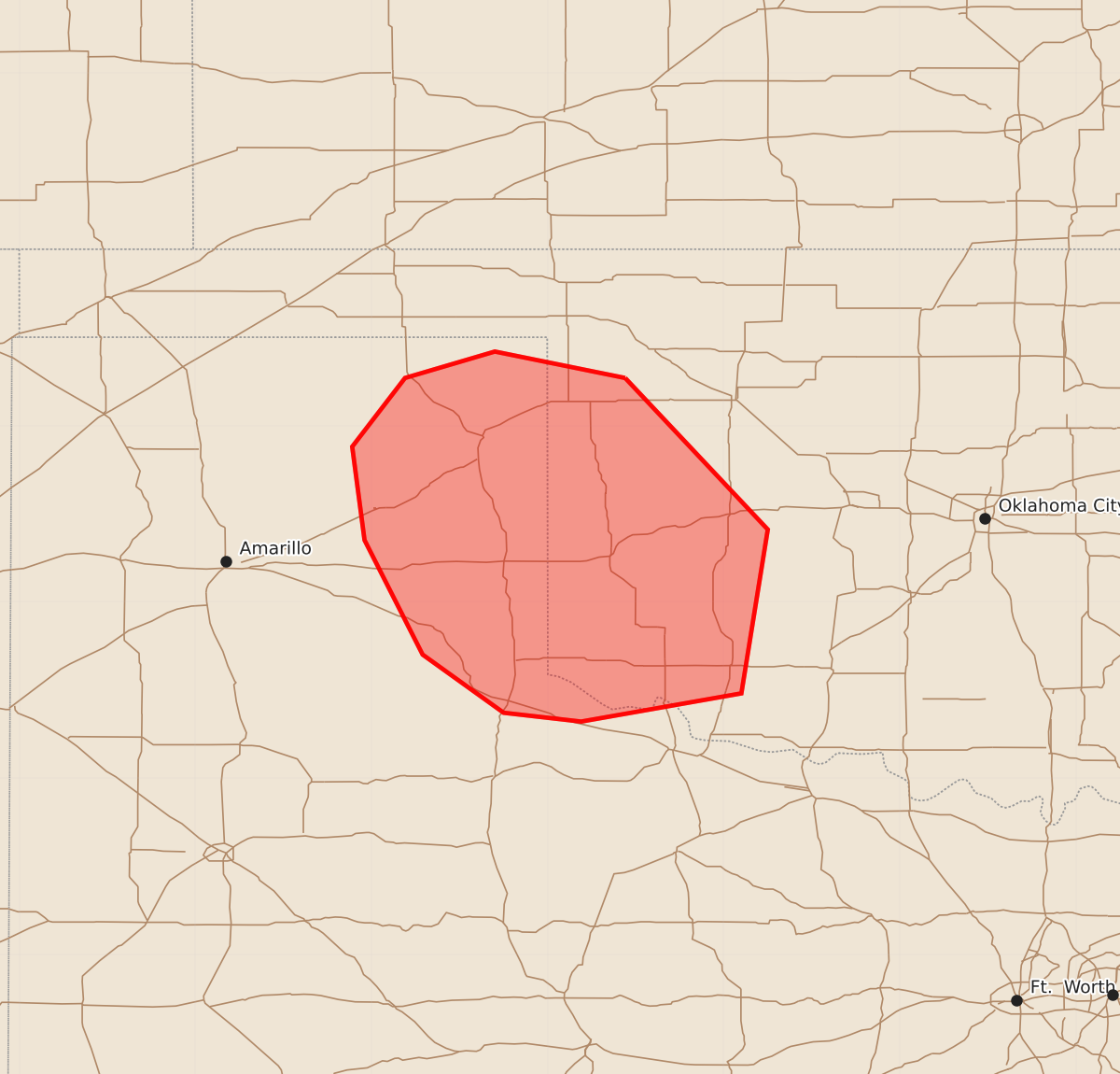
Damaging winds are possible across western Oklahoma and the eastern Texas Panhandle during the morning of Tuesday, June 23. Potential wind gusts could reach 65 to 80 mph.
Product Text
000 ACUS11 KWNS 231415 SWOMCD SPC MCD 231415 OKZ000-TXZ000-231545- Mesoscale Discussion 1270 NWS Storm Prediction Center Norman OK 0915 AM CDT Tue Jun 23 2026 Areas affected...western OK into the TX Panhandle Concerning...Severe potential...Watch possible Valid 231415Z - 231545Z Probability of Watch Issuance...60 percent SUMMARY...Damaging wind potential may increase this morning across the eastern Texas Panhandle into western Oklahoma. Trends are being monitored for possible watch issuance. DISCUSSION...Clustering of ongoing convection has increased over the past hour across the northeast TX Panhandle into adjacent portions of western OK. This activity has been expanding on its western flank as a modest southwesterly low-level jet is apparent from the KAMA VWP. This activity is growing within moderate west/northwesterly flow aloft and amid 40+ kt effective shear magnitudes. Low-level winds are relatively weak, but east/southeasterly near-surface flow as allowed upper 60s to low 70s F dewpoints to overspread the region. This cluster may persist southward this morning into this very moist airmass and along a moderate/strong instability gradient oriented across western OK and the TX Panhandle. A recent gust to 41 mph was noted at the Lipscomb West TX Mesonet site. While some low-level inhibition is noted in SPC Mesoanalysis, filtered heating and clearing across southwest OK into western North TX has temperatures quickly approaching the low 80s. It is uncertain if continued strengthening/organization will be occur given the expectation for a gradually weakening low-level jet through the morning. Modest low-level inhibition may preclude a more robust severe risk if further organization does not occur. However, if this cluster continues to strengthen, some damaging wind risk will be possible downstream across the eastern TX Panhandle into southwest OK. Trends are being monitored for possible watch issuance. ..Leitman/Guyer.. 06/23/2026 ...Please see www.spc.noaa.gov for graphic product... ATTN...WFO...OUN...LUB...AMA... LAT...LON 36279956 35419875 34489890 34329981 34370025 34700071 35350104 35880111 36270081 36420030 36279956 MOST PROBABLE PEAK TORNADO INTENSITY...UP TO 90 MPH MOST PROBABLE PEAK WIND GUST...65-80 MPH MOST PROBABLE PEAK HAIL SIZE...1.00-1.75 IN