Mesoscale Discussion 1982
Issued: · Valid: –
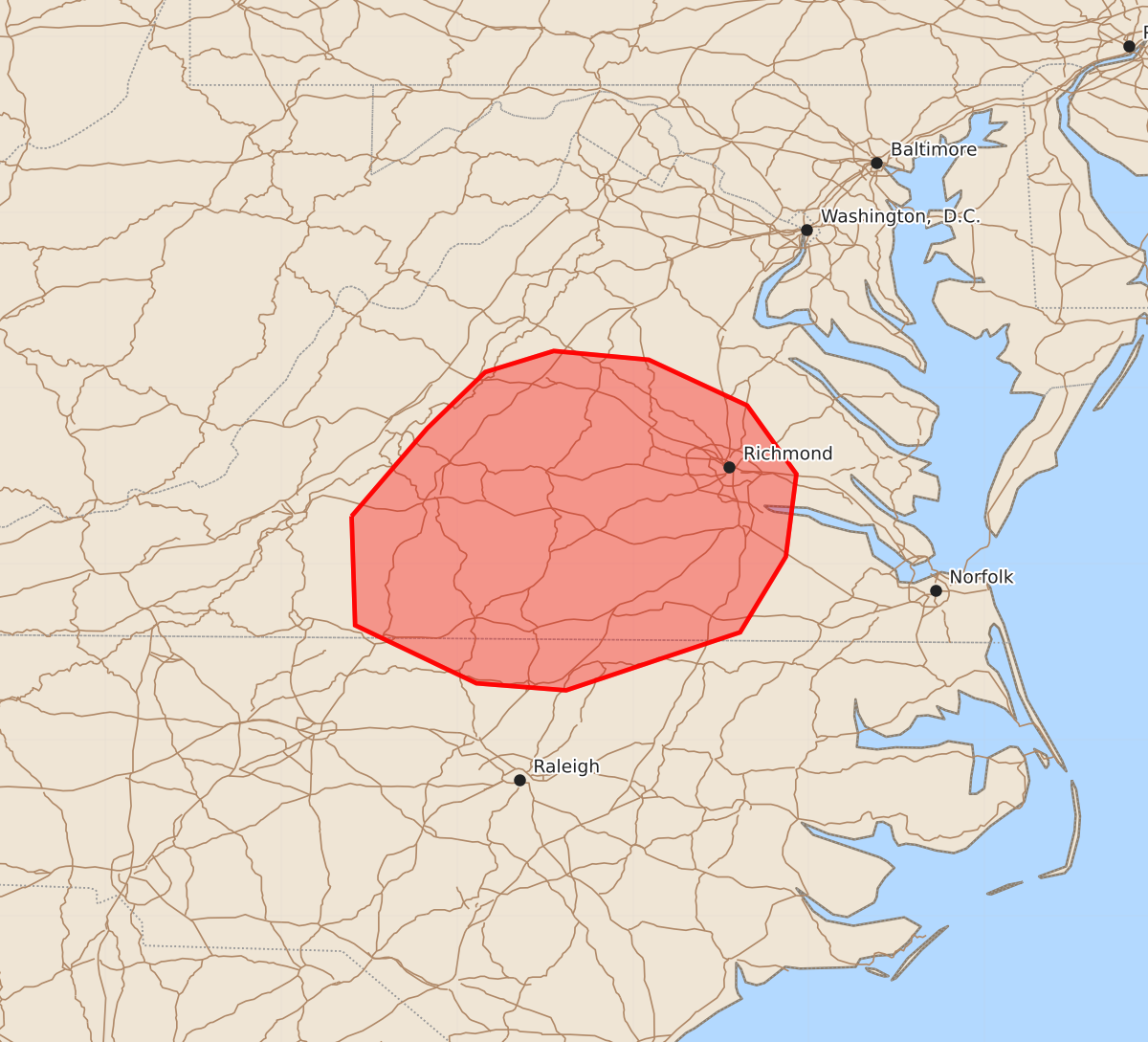
Summary
Severe thunderstorms capable of producing damaging winds and large hail are expected across northern Virginia and north-central North Carolina through the late afternoon and early evening. The storms may bring wind gusts up to 60 mph and hail up to 2.5 inches in size.
Product Text
000 ACUS11 KWNS 142202 SWOMCD SPC MCD 142202 VAZ000-NCZ000-150000- Mesoscale Discussion 1982 NWS Storm Prediction Center Norman OK 0502 PM CDT Fri Aug 14 2026 Areas affected...northern Virginia into north-central North Carolina Concerning...Severe potential...Severe Thunderstorm Watch likely Valid 142202Z - 150000Z Probability of Watch Issuance...80 percent SUMMARY...Continued risk for damaging wind may continue through the late afternoon/early evening. DISCUSSION...Mixed mode thunderstorm activity is ongoing along and south of a surface boundary across portions of Virginia this afternoon. A cluster has developed across south-central Virginia and is moving southeastward. The environment downstream of this cluster is moderately to strongly unstable. Daytime heating has allowed temperatures to rise into the mid 90s, with steepening low-level lapse rates. Deep layer shear decreases with southward extent but it is possible that with cold pool organization, the damaging wind potential may increase as this line shifts southeastward into the favorable environment. Closer to the northern boundary within the more favorable deep layer shear, a supercell is moving south east across north-central Virginia. While deep layer shear is sufficient, low level flow is fairly week. This will likely keep the main threats to large hail and damaging wind. Watch issuance is being considered soon. ..Thornton/Gleason.. 08/14/2026 ...Please see www.spc.noaa.gov for graphic product... ATTN...WFO...AKQ...LWX...RAH...RNK... LAT...LON 37277960 37777917 38097884 38217845 38167791 37907735 37517707 37047713 36617739 36287838 36327889 36657958 37277960 MOST PROBABLE PEAK WIND GUST...UP TO 60 MPH MOST PROBABLE PEAK HAIL SIZE...1.50-2.50 IN