Mesoscale Discussion 2168
Issued: · Valid: –
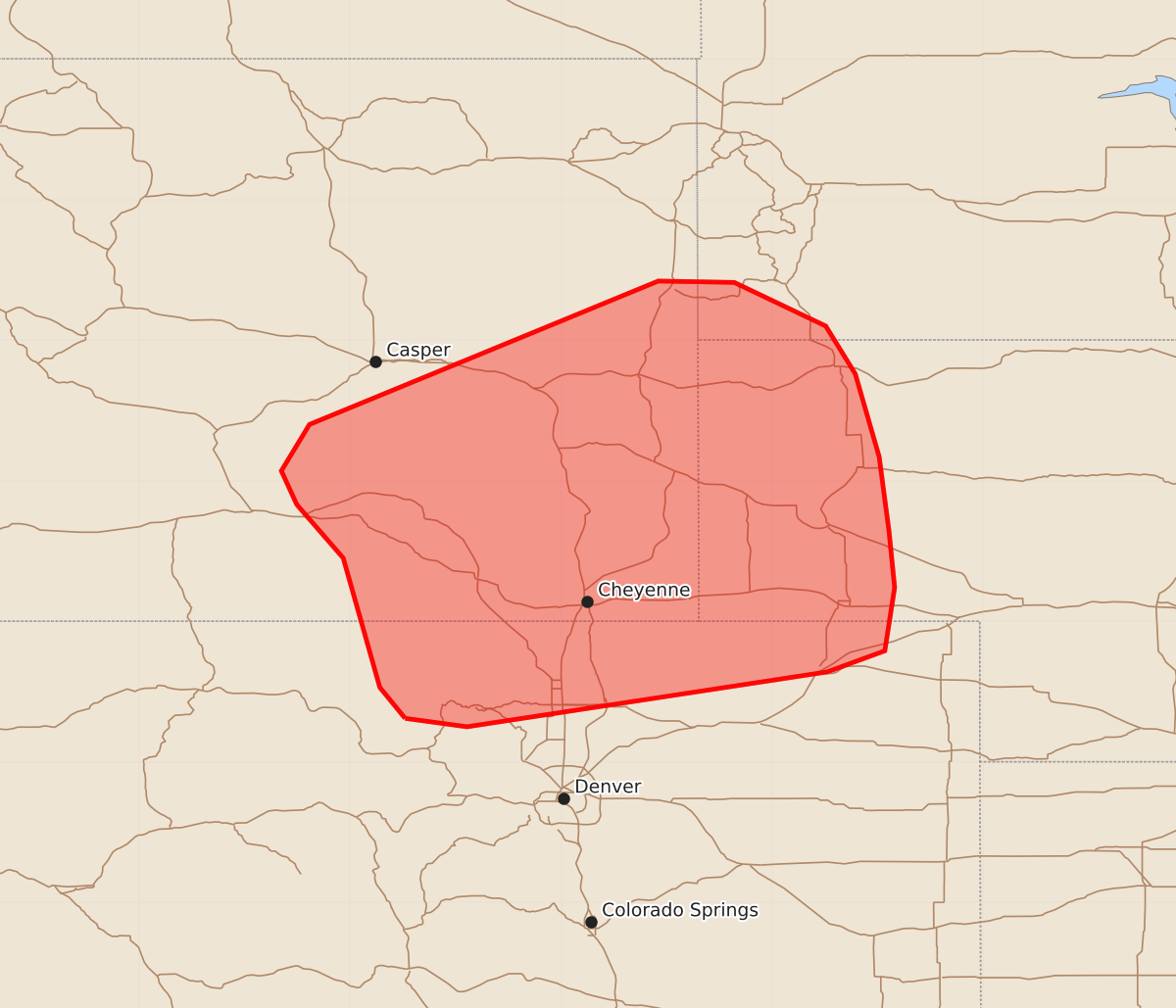
Summary
Sporadic severe wind gusts are possible across southeast Wyoming, northern Colorado, the Nebraska Panhandle, and southwest South Dakota through late afternoon. Wind gusts could reach speeds between 65 and 80 mph.
Product Text
000 ACUS11 KWNS 291927 SWOMCD SPC MCD 291926 NEZ000-COZ000-SDZ000-WYZ000-292130- Mesoscale Discussion 2168 NWS Storm Prediction Center Norman OK 0226 PM CDT Sat Aug 29 2026 Areas affected...Southeast Wyoming and northern Colorado into far western Nebraska and southwest South Dakota Concerning...Severe potential...Watch unlikely Valid 291926Z - 292130Z Probability of Watch Issuance...20 percent SUMMARY...Sporadic severe wind gusts may become more probable across southeast Wyoming/northern Colorado and into the Nebraska Panhandle (and possibly far southwest South Dakota) through late afternoon as high-based convection spreads east. DISCUSSION...A band of high-based convection has been monitored over the past 1-2 hours as it translates across southern WY with a slight intensification trend noted via falling cloud-top temperatures. This intensification trend appears to be confirmed by a recent 71 mph wind gust at KRWL (Rawlins, WY) associated with one of the deeper cores within the band. Further south into northern CO, additional high-based convection is noted immediately ahead of a weak vorticity maximum. Downstream of this activity, surface temperatures continue to warm into the low 80s to low 90s, which appears to be eroding lingering inhibition based on modified regional 18z soundings and GOES imagery and supporting MLCAPE values on the order of 250-500 J/kg as well as 8-9 C/km low-level lapse rates. Ongoing convection may experience further intensification as it moves into this somewhat more buoyant environment, resulting in increased efficiency of downward transport of 40-50 knot mid-level flow that is associated with a narrow 500 mb jet but resides well within the CAPE-bearing layer. Some guidance - notably RRFS solutions - hints at a more consolidated cluster/swath of severe winds emerging over the next couple of hours, but most recent solutions hint that lingering MLCIN may be in place downstream within the warm sector. A 19z ACARs sounding from Denver, CO sampled some lingering inhibition, but may not be fully representative of the more moist air mass further north/northeast due to the influence of weak westerly downslope flow. As such, confidence in the coverage of the severe wind threat is limited and may be focused to where daytime heating will be maximized in the coming hours. Regardless, sporadic severe gusts appear probable as thunderstorm coverage increases through late afternoon. ..Moore/Mosier.. 08/29/2026 ...Please see www.spc.noaa.gov for graphic product... ATTN...WFO...LBF...UNR...BOU...CYS...RIW... LAT...LON 40310611 40530629 41450655 41830688 42070699 42400679 43420431 43410377 43100312 42760291 42170274 41640267 41240263 40790270 40640311 40250567 40310611 MOST PROBABLE PEAK WIND GUST...65-80 MPH