Mesoscale Discussion 1290
Issued: · Valid: –
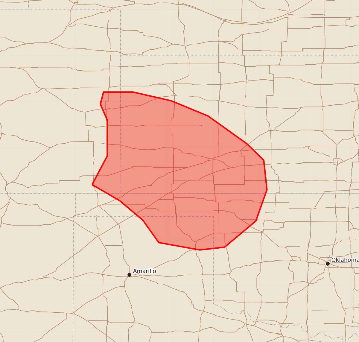
Summary
Severe thunderstorms capable of producing localized damaging wind gusts and hail may impact western Kansas, the Texas Panhandle, and northwest Oklahoma through mid-morning Wednesday. Expected severity includes wind gusts of 55-70 mph and hail between 1.00 and 1.75 inches.
Product Text
000 ACUS11 KWNS 240811 SWOMCD SPC MCD 240811 KSZ000-OKZ000-TXZ000-COZ000-241115- Mesoscale Discussion 1290 NWS Storm Prediction Center Norman OK 0311 AM CDT Wed Jun 24 2026 Areas affected...western Kansas into the Panhandles and northwest Oklahoma Concerning...Severe Thunderstorm Watch 386... Valid 240811Z - 241115Z The severe weather threat for Severe Thunderstorm Watch 386 continues. SUMMARY...Potential for localized severe hail or wind gusts exists into western Kansas, and extending southeast of the existing watch into the northeast Texas Panhandle and far northwest Oklahoma. Additional watches are not anticipated at this time. DISCUSSION...Outflow associated with earlier severe storms over eastern CO is now pushing into southwest KS, and is intersecting a northwest to southeast oriented line of elevated storms in a zone of theta-e advection associated with southerly 850 mb winds. VWPs from AMA to GLD indicate around 15-20 kt out of the south to southeast. The primary instability axis stretches from southeast CO into northwest OK, and while SBCIN is increasing, elevated instability should continue to support areas of new development. New storm cores may produce hail briefly, and locally damaging gusts may still occur. At this time it appears the cold pool from southeast CO into southwest KS may not be sufficient for significant upscale MCS growth. However, there is non-zero potential, and the area south/southeast of WW 386 will continue to be monitored this morning. ..Jewell.. 06/24/2026 ...Please see www.spc.noaa.gov for graphic product... ATTN...WFO...OUN...DDC...GLD...AMA...PUB... LAT...LON 37190264 37810231 38590231 38940246 39200239 39200175 39010092 38680012 38089928 37729891 37089884 36409908 35839976 35770030 35930119 36420154 36840204 37190264 MOST PROBABLE PEAK WIND GUST...55-70 MPH MOST PROBABLE PEAK HAIL SIZE...1.00-1.75 IN